Savandurga Hill
|
About:
|
.jpg)
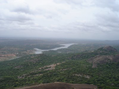
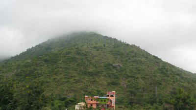
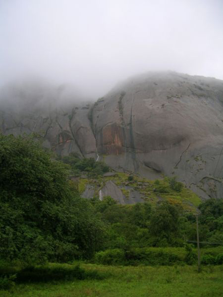
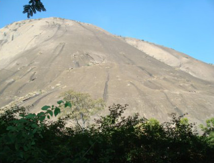
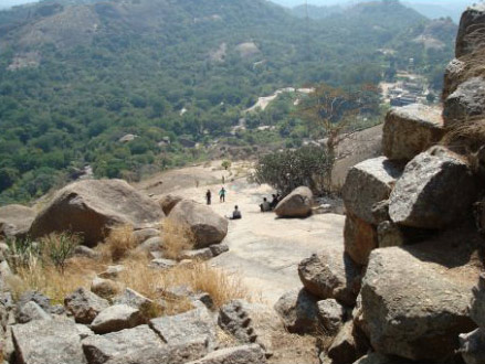
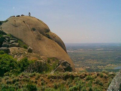
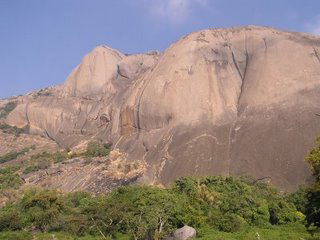
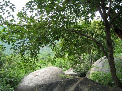
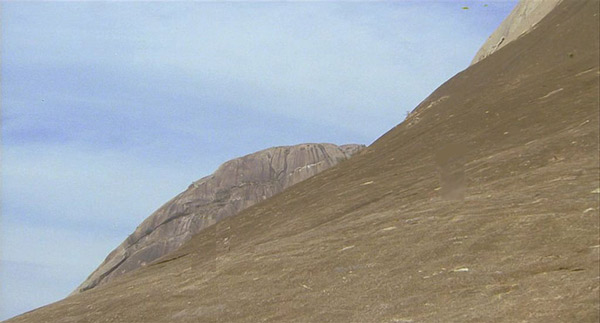
Savanadurga Hill, one of Asia’s largest monolithic hills, is located in Karnataka, about 60 km from Bangalore. Rising to around 1,200 meters above sea level, the hill is made up of two distinct peaks, Karigudda (Black Hill) and Biligudda (White Hill). Known for its rocky landscape and challenging trails, Savanadurga is a popular destination for trekkers, rock climbers, and adventure seekers. The hill is surrounded by dense forests, and its rugged terrain is part of the Deccan Plateau. It also has cultural significance, with a small fort and a few ancient temples dedicated to local deities. The peaceful and scenic location, coupled with panoramic views of the surrounding landscapes, makes Savanadurga an ideal spot for day trips and outdoor exploration. Savanadurga Hill is also part of a protected area, supporting various species of flora and fauna, and visitors may occasionally spot wildlife such as peacocks, lizards, and occasionally leopards.
Rising to an altitude of 1226 m above the sea level, these hills are
considered to be one of the largest monolith hills in India. Savandurga
Hills form a part of the Deccan plateau and comprise of peninsular gneiss,
laterites, basic dykes and granites. They consist of two hills, namely
Karigudda (black hill) and Billigudda (white hill). In the following lines,
we have provided more information about Savandurga Hills near Bangalore,
India.
Savandurga is formed by two hills known locally as Karigudda (black hill) and
Biligudda (white hill). The earliest record of the name of the hill is from
1340 AD by Hoysala Ballala III from Madabalu where it is called Savandi.
Another view is that the name is originated from Samantadurga attributed to
a Samantharaya, a governor under Ahchutaraya at Magadi, although there is no
inscription confirming this.
|
Location info:
|
| Address:Savandurga Hill, Bangalore,Karnataka,India |
| District: Bangalore |
| Nearest City: Bangalore |
| Best time to visit: November to April |
Climate/Weather of Savandurga Hill:
|
| Monsoon: Heavy rain from June to September, making the rocky surfaces slippery.
Winter: Cool and pleasant, between 15°C to 25°C, ideal for trekking.
Summer: Warm, ranging from 25°C to 35°C, with the sun making it challenging to climb later in the day. |
History of Savandurga Hill:
|
| Savanadurga has historical and cultural significance dating back to the 16th century. The hill fort on Savanadurga was initially built during the reign of the Kempe Gowda dynasty, who were instrumental in founding and fortifying Bangalore. Later, it came under the control of various empires, including the Mysore Wodeyars and subsequently Tipu Sultan, who used the fort as a defensive post. Known as Savandurga Fort, it played a key role in defending the region against British forces during the Anglo-Mysore Wars. However, the British eventually captured it in 1791. Due to its strategic elevation and challenging terrain, Savanadurga was considered nearly impregnable and earned the title “a place of strength” from British forces. The hill also has religious significance, with shrines at the foothills dedicated to Hindu deities such as Sri Lakshmi Narasimha Swamy and Veerabhadra Swamy, making it a pilgrimage site as well as a natural wonder. Over the centuries, Savanadurga has transformed from a fortified stronghold to a nature retreat and adventure destination, blending history with natural beauty.
|
Interesting things to do:
|
Trekking:
We were five comprising Ananda H.M.(Organizer), Sameer
Nagaich, Venkatesh, Babu & myself. That was 10:30am on June 23,2007 when we
reached the base. A climate just bespoken for the expedition with sun hiding
somewhere within the clouds, small drizzle now & then and gentle winds.
Sameer added his words to this saying "The climate would've never got better
than this!".Thankfully, there is a safe & convenient way has been marked
with arrows as to direct trekkers to the destination. The trek comprised of 4
checkpoints commemorated with four different fort walls coming all over the way.
Venkatesh inaugurated the trek with a joke saying "Aa, Tensingh gu saha havaai
chappali hakkondu ee betta hattakaagalla. Aadre naavu hakkondu hogidvi
gotta!(Even Tensingh can't climb this mountain wearing slippers, but we've done
that!).
Forest Walking:
After lunch & a little relaxation started a
hiking over the forest countryside on the other side of the mountain and the
way to that begins from the park itself. This showed a real adventure of
walking at a no-man area, surprisingly we are again accompanied by Fathima
all over the way. This is again 1.5 hours of walk through camping area,
woods, ponds and rocks. We reached place of an old abandoned temple in midst
of the woods. We stayed, slept, tattled there for almost an hour or so. At
5:00pm in the evening we are about to prepare our tea, but our portable gas
stove didn't light up and we have to return without having tea. Finally
again after continuous walk for an hour we reached the park gate where our
vehicle stood. We could see Fathima waving a bye for all of us with her
tail, saying her a goodbye & few biscuits we are on the go way back to
the concrete jungle called Bengaluru.
|
Interesting things to Visit:
|
- Veerabhadra Swamy Temple
- Narasimha Swamy temple
- Manchanabele Dam
- Magadi
- Ramanagara Hills
|
Mobile range info:
|
| Mobile coverage is generally available, but the signal strength can vary on the higher elevations. BSNL often provides the best coverage in rural areas. It’s advisable to inform someone of your travel plans due to potential weak signals at higher altitudes.
|
How to reach Savandurga Hill?
|
| Nearest Railway Station:Bangalore railway station |
| Nearest Airport:Bangalore airport |
| Road Transport:Savanadurga is about 50 Kms away from Bangalore. You could
take a bus from Bangalore or come here by your bike or car. The easiest route is
to take the Magadi Road until you reach Magadi town. After this you will have to
take a left towards Ramanagram and reach Nayakanapalya. Take a left here again
and proceed further to reach Savandurga. The local villagers are helpful with
directions. |
Nearest Visiting places in Savandurga Hill:
|
The Bangalore Palace & Fort:
The Bangalore Fort was built by
Kempe Gowda and expanded by Tippu Sultan. Within its walls is the well preserved
16th century Ganapathi Temple.The Bangalore Palace was built by a Wodeyar king
in 1887 on the 400 acre space. Inspired by the Windsor castle, this palace was
built in the Tudor style, complete with Gothic windows, foiled windows,
battlements and turrets resembling the Daria Daulat Palace in Srirangapatanam,
this summer palace has been constructed largely of wood and is famous for its
carving and paintings.
Lal Bagh:
Hyder Ali laid out this famous botanical garden and
his son added horticultural wealth to them by importing trees and plants
from several countries. The garden today houses over 1000 species of flora
which include rare and enchanting collection of tropical plants, trees and
herbs. The Glass House, modelled along London's Crystal Palace, is the
center of attraction in this 2400 acre park. Bi-annual flower shows
attracting participants from all over India is held in the Glass House. In
July, 2003 it was decided that the Department of Horticulture and Bangalore
Development Authority (BDA) would jointly take up the development of Lal
Bagh Botanical Gardens.
ISKCON:
Situated on Chord Road, it is a must visit temple in
Bangalore. It stands over a small hill and is a very clean and well
maintained temple. Akshaya Patra program sponsored by the temple is very
popular.
Bull Temple:
This temple, built by Kempe Gowda, houses the
magnificent stone statue of the sacred bull, Nandi. It stands over 15 feet
tall and is over 20 feet long . In Nov/Dec every year, when the groundnuts
have been harvested, a groundnut fair is held near the temple. The first
groundnuts are offered by the farmers to the sacred bull.
Gangadhareshware Temple:
Known for its four monolithic pillars
and rare idol of Agni, the God of fire,this temple was built by Kempe Gowda.
A unique phenomena is witnessed here on Jan 13/14th every year when the rays
of the setting sun enter through the window, pass between the horns of the
Nandi and shine on the Shivalingam.
Dharmaraja Temple:
Located at Nazarethpet in the suburbs of
Bangalore, this temple is the starting point of the annual Karaga
procession. The revered idols of this temple are the Shri Dharmaraja Swamy,
hero of the Mahabharata and Lord Krishna.
|
Nearest Petrol Pump:
|
| Petrol Pump:Bengaluru,Karnataka,India |
Hotels/Lodge/Accommodation nearby Savandurga Hill:
|
|
Homestays: Available near Ramanagara and Magadi, offering a comfortable stay close to nature.
Bangalore: For more hotel options, Bangalore city is about 60 km away, offering a range of accommodations.
Camping: Although not allowed directly on Savanadurga, nearby areas may offer safe spots for campers.
|
Things to carry:
|
| Comfortable trekking shoes and durable clothing for climbing.
Plenty of water, as the ascent can be exhausting.
Snacks and energy bars.
Hat, sunglasses, and sunscreen for protection.
A first-aid kit and any personal medications.
Camera and binoculars for photography and bird watching. |
Tips & Suggestions for Savandurga Hill:
|
| Trek early in the morning to avoid the heat, especially in summer.
Exercise caution during the monsoon season, as the rocks can be slippery.
Stick to designated trails, as the steep cliffs can be dangerous.
Avoid littering and maintain the natural environment.
Respect local customs, especially at the temples near the base. |
Help Line/Phone Number:
|
| Police Station:100 |
Nearest Hospital:
Wockhardt Hospital:No. 23, 80 feet road, Guru
Krupa Layout, Nagarabhavi,Bangalore,Karnataka,India,ph:080 23014444
Shushruti Hospital And Research Centre:Shushruti Nagar,Andrahalli Main Road,
Peenya 2nd Stage,Bengaluru,Karnataka,ph:080 28362040 |

.jpg)
