Bangalore Rural District
Bangalore Rural District |
|
About: |
|
|
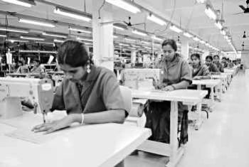
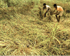
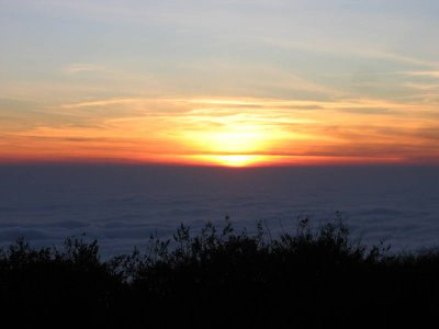
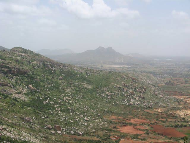
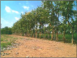
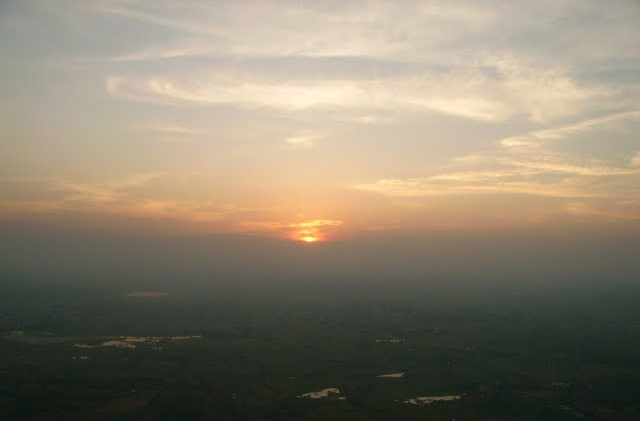
The Bangalore Rural District derives its name from Bangalore (head quarters town) and majority of the district consists of Rural Areas. The Bangalore Rural district is essentially an agriculture district but it has sufficient scope for industrialisation, dairy development and sericulture.Bangalore Rural District is one of the 27 districts in Karnataka. It was formed in 1986, when Bangalore district was divided into Bangalore Rural and Bangalore (Urban). Presently in Bangalore Rural district, there are 2 divisions, 4 Talukas, 35 Hoblis (cluster of villages), 1,713 inhabited and 177 uninhabited villages, 9 towns, and 229 Gram Panchayats. Proximity to the city of Bangalore has its own impact on the district, with a considerable daily commuting population. The rural people are mostly agriculturists with their other occupations serving only as subsidiary to agriculture. Bangalore Rural District is located in the South-Eastern corner of Karnataka State spreading over an area of 5,814 sq km. The District is bounded on the North by Tumkur and Kolar Districts; on the South by Mandya and Mysore Districts and Tamil Nadu State; on the east by Kolar District and Tamil Nadu State and on the West by Tumkur and Mandya Districts. Bangalore Rural district enjoys a captivating landscape because of its unevenness in topography. The major portion of Bangalore rural district lies in the Arkavati valley. The Arkavati, the Kanva and the Dakshina pinakini are the rivers which flow through the district in the general direction from north to south.The district is endowed with agricultural and horticultural crops such as ragi, rice, groundnut, sugarcane, castor, grapes, mulberry, etc. There are adequate infrastructural facilities such as transport and communications, banking, credit, and marketing. Though the region is not rich in mineral resources, its non-metallic mineral resources are utilised for bricks, tiles, and stoneware manufacture. For many years now, weaving has also been a major occupation for a large section of the population. The soil and such climatic conditions are congenial for the cultivation of mulberry, rearing of silkworms, and production of silk, besides other agro-based industries.
|
|
Location info: |
|
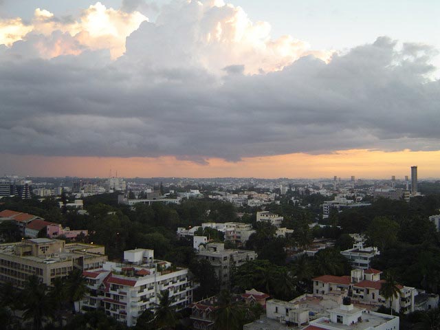
| Bangalore Rural District includes the rural area of south-east Karnataka around the city of Bangalore | |
Climate/Weather of Bangalore Rural District: |
|
History of Bangalore Rural District: |
|
|
Historically, the earliest dynasty which established its sway over this district is that of the Gangas. In about the fourth century A.D., the Gangas established themselves at Kolar and the territory comprised in Bangalore Rural district formed part of Gangavadi 96,000 and Honganur of Channapatna Taluk was the chief town of a sub-division, called Chikka Gangavadi, which occupied the Shimsha valley. During the Seventh century, Mankund was a place of great importance and was the second royal residence of Ganga Bhuvikrama(654-79) and also of Shivamara(679-726). In the eight century Shri Purusha made Manyapura ( Manne of Nelamangala Taluk) his royal residence and later it was a major center under the Rashtrakutas. Manne or Mannekadakam of Tamil records had been the headquarters of Rashtrakutas Governor Kambarasa. Certain parts of the district, especially in the East, were held by the Nolamb Pallavas. The Bangalore Rural district was split from the urban district of Bangalore in 1986. |
|
Educational Institutions of Bangalore Rural District: |
|
|
Education in Bangalore (Rural)
|
|
Langauge |
|
| The prominent language spoken is Kannada. Other languages like Urdu,Telugu. | |
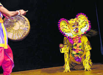
Culture: |
|
How to reach? |
|
| Nearest Railway Station:Bangalore Rural District is connected by railway lines with almost all the important places in South India. | |
| Nearest Airport:Bangalore International Airport | |
| Road Transport:Straight (76 km) on NH48 Hwy going toward Hassan Bypass.Leave Channarayapatna.Via Mandya District at 39 km.Enter Tumkur District at 52 km.Via Kunigal at 75 km.Enter Bangalore Rural District at 80 km. | |
Tourist Attraction |
|
|
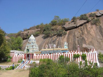
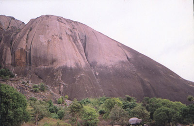
Kabbal Durga:A rocky hill with a temple of Goddess KabbaLamma at the top in Bangalore (Rural) district just a few kilometers away from the Kanakapura Bheemeshwari road.The Kabbal Durga gets its name from the Goddess KabbaLamma and fort (Durga is Kannada for fort) present at the top of the hill. Only the ruins can be seen now.There is a village by the same name at the foothill. Sivagange: 8 km from Dabas Pet on the way to Tumkur from Bangalore.Shivagange gets its name from the Holy places and temples it hosts. The spring water found here is considered to the sacred water 'Gange'.The hillock has few temples atop and a statue of Nandi carved out of single stone is a beauty. It is about two kilometers from the bottom of the hillock where there is a village to the top of the hill. There are many temples all along the way. Sawandurga: About 50 Km from west of Bangalore Mekedaatu (Goat's Leap'): Its about 90 Km from Bangalore via Kanakapura, where the rivers Cauvery and Arkavathi after their confluence at the Sangama.Mekedatu is a beautiful picnic spot where the rivers Cauvery and Arkavathi after their confluence at the Sangam, squeeze though a narrow gorge. Kengal hanumantharaaya temple, Channapatna Ghati Subrahmanya temple near Doddaballapura Nandi Hills: 65 Km from Bangalore. It was Tipu Sultan's summer retreat and Tipu's fort walls still stand as testimony to history. The rivers Pennar, Palar and Arkavati originate from these hills. The Tipu's Drop, a 600 meter high cliff, where prisoners were hurled down the precipice is an awe-inspiring sight. Channapatna Toys: Channapatna, a small hamlet 46 kms. from Bangalore on the Mysore highway, excels in lacquerware, a craft practised today by over 3000 local craftspersons. Devanahalli Fort:The fort was built in 1501 by Mallabairegowda of Avati clan, with the consent of "Devappa" a feudatory at Devanadoddi. Subsequently the name was changed to Devanahalli.The fort remained under the Avati rulers until 1747, when Mysore Dalawai, Nanjarajaiah, attacked the fort and captured it. Subsequently Devanahalli was usurped by the Marathas and reclaimed by the Mysore army under the leadership of Haider Ali.During the reign of Tipu Sultan Lord Cornwallis laid siege to the fort and took possession of it during the Mysore War of 1791. Kaveri Fishing Camp, Bhimeswari (Ramnagar):The river Kaveri at Bhimeswari, abounds in a variety of fish including the Carnatic Carp and the Mahseer. Manchina Bele, Magadi:This is about 36 km from Bangalore by road and about 8 km from the Big Banyan Tree. Manchinabele Dam is situated in the midst of hills and forests. Even though it is not a big dam, it is a good picnic spot. Sawan Durga :sawandurgaIn Kannada Durga means Fort (also Goddess Amba). Savan Durga being one of the nine such forts around Bangalore, is situated at a distance of around 50 kms west of Bangalore near Magadi.There are several routes to the monolith at Sawana Durga, rising to the height of more than 1000ft, At the foothill there is a village by the same name and the forest around has been declared as Reserved forest and there is protected garden of the Herbs of medicinal interest |
|
Hotels/Lodge/Accommodation nearby Bangalore Rural District: |
|
| There are lots of hotels at Bangalore City as well as at taluks in Bangalore Rural District | |
Links |
|
| http://www.bangalorerural.nic.in/ http://en.wikipedia.org/wiki/Bangalore_Rural_District |
|
Bangalore Rural District Major Attraction |
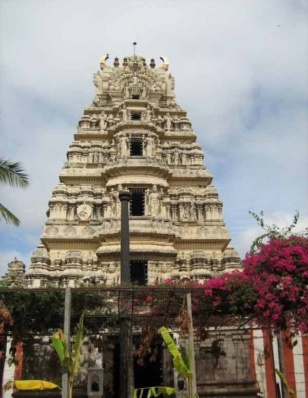
| Ghati Subramanya |
| Ghati Subramanya is one of the popular pilgrim centers located near Doddaballapur of Bangalore Rural district. Ghati Subrahmanya is located about 60 Kms from Bangalore.The temple here is dedicated to Lord Subramanya and Lord Lakshmi Narasimha. It is believed that the idol of Shri subrahmanya is self originated.....more |
| Bannerghatta National Park-Karnataka |
| Bannerghatta National Park is about 25 km from Bangalore. The National Park boasts of Tiger or Lion safari which takes you on tour of the section where the big cats roam free. You ride inside a poorly designed diesel bus while the animals peer at you quite close by.....more |
| Chunchi Falls |
| Chunchi Waterfalls The waterfall is on tributary of Kaveri, lying amidst rocky hills with shrub vegetation. It is a small deviation from the road to Mekedatu, famous for the waterfall through a small gap between two rocks.....more |
| Muthyala Maduvu Waterfall |
| Muthyalamaduvu is a picnic spot near Anekal, 40 km from Bangalore, Karnataka, India.In the local Kannada language, Muthyalamaduvu means 'pearl valley' (muthu = pearl and maduvu = valley), apparently named for its 92 meter waterfall, whose falling water appears to look like drops of pearl.....more |
| Vrishabhavathi River |
| The Vrishabhavathi River is a minor river that flows north of the Indian city of Bangalore. The Vrishabhavathi is a tributary of the Arkavathy River. The majority of the sewage emanating from Bangalore is carried by these two rivers.....more |
SELECT YOUR HOLIDAY DESTINATION
-
Aero Sports in Karnataka
-
Archaeology in Karnataka
-
Beaches in Karnataka
-
Bird Sanctuaries in Karnataka
-
Bouldering Spot in Karnataka
-
Camping in Karnataka
-
Cave Explorations in Karnataka
-
Culturals Place in Karnataka
-
Dams in Karnataka
-
Districts Of Karnataka
-
Fairs in Karnataka
-
Festivals in Karnataka
-
Go-Karting in Karnataka
-
Hill Stations in Karnataka
-
Historical Places in Karnataka
-
Holiday Resorts in Karnataka
-
Islands in Karnataka
-
Landscape in Karnataka
-
Mountain Biking in Karnataka
-
National Parks in Karnataka
-
Orbit Network
-
Pilgrims Destinations
-
Para-sailing in Karnataka
-
River rafting in Karnataka
-
Rivers in Karnataka
-
Rock Climbing in Karnataka
-
Safari in Karnataka
-
Temples in Karnataka
-
Trekking in Karnataka
-
Water Sports in Karnataka
-
Waterfalls in Karnataka
-
Wildlife Sanctuaries in Karnataka