Introduction
Seismic Interpretation Software is a specialized platform that allows geoscientists, exploration teams, and energy companies to analyze seismic data, create subsurface models, and identify potential oil, gas, or mineral deposits. These platforms help streamline interpretation, improve decision-making, and reduce exploration risk by integrating visualization, analytics, and modeling tools.
Real-world use cases include:
- Oil and gas companies mapping subsurface formations for exploration
- Geophysical teams analyzing 2D and 3D seismic datasets
- Mining companies assessing underground mineral deposits
- Reservoir engineers creating geological models to predict extraction potential
- Geoscientists integrating seismic and well log data for exploration planning
Evaluation criteria for buyers:
- 2D and 3D seismic visualization capabilities
- Fault and horizon interpretation tools
- Integration with well logs and geological data
- Analytics for reservoir modeling
- Automated feature detection and AI-assisted interpretation
- Scalability for large datasets
- Cloud, hybrid, or on-premises deployment
- User access controls and security
- Mobile and desktop accessibility
- Customer support and training resources
Best for: Oil and gas exploration teams, geoscientists, reservoir engineers, and mining geophysicists
Not ideal for: Small-scale exploration or educational projects where simple or free visualization tools may suffice
Key Trends in Seismic Interpretation Software
- AI-assisted feature detection to speed up interpretation
- Cloud-based platforms for large dataset management
- Real-time collaboration for geoscience teams
- Integration with geological modeling and reservoir simulation software
- Enhanced 3D and 4D visualization capabilities
- Automated fault and horizon detection
- Predictive analytics for reservoir and resource assessment
- Mobile access and remote collaboration features
- Multi-vendor data compatibility for seamless workflows
- Regulatory reporting and compliance support
How We Selected These Tools (Methodology)
- Evaluated global adoption and recognition among exploration companies
- Assessed feature completeness including interpretation, modeling, and analytics
- Reviewed reliability and performance on large seismic datasets
- Verified security, user roles, and data protection measures
- Analyzed integration capabilities with well logs, modeling, and simulation tools
- Considered scalability for small to enterprise exploration projects
- Factored mobile, cloud, and desktop accessibility
- Evaluated AI-assisted and automation capabilities
- Assessed user experience and onboarding requirements
- Reviewed vendor support and community engagement
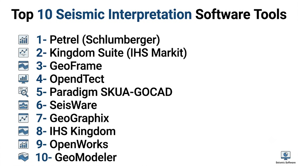
Top 10 Seismic Interpretation Software Tools
1- Petrel (Schlumberger)
Short description: Enterprise-grade platform for seismic interpretation, reservoir modeling, and subsurface analysis
Key Features
- 2D and 3D seismic visualization
- Fault and horizon interpretation
- Reservoir modeling and simulation
- Integration with well log data
- Collaborative workflows
- Automated interpretation tools
- API support
Pros
- Comprehensive enterprise features
- Scales for large datasets
- Strong collaboration tools
Cons
- High cost for small teams
- Steep learning curve
- Integration setup may be complex
Platforms / Deployment
Windows / Cloud / On-prem
Security & Compliance
Not publicly stated
Integrations & Ecosystem
Works with geological modeling and reservoir simulation tools
- Well log integration
- Reservoir simulation software
- API modules
Support & Community
Varies / Not publicly stated
2- Kingdom Suite (IHS Markit)
Short description: Seismic interpretation and geophysical analysis platform for exploration and production teams
Key Features
- 2D/3D seismic interpretation
- Fault and horizon mapping
- Data integration with well logs
- Geophysical analytics
- Automated interpretation assistance
- Collaborative project management
- Visualization dashboards
Pros
- Easy-to-use interface
- Scales for multi-user projects
- Strong integration with geophysical datasets
Cons
- Limited advanced modeling compared to enterprise platforms
- Higher license cost for full suite
- Some features require training
Platforms / Deployment
Windows / Cloud
Security & Compliance
Not publicly stated
Integrations & Ecosystem
Integrates with Petrel and reservoir modeling tools
- Well log integration
- Geophysical datasets
- API for automation
Support & Community
Varies / Not publicly stated
3- GeoFrame
Short description: Comprehensive platform for seismic interpretation, well correlation, and reservoir characterization
Key Features
- 2D/3D seismic visualization
- Well correlation and mapping
- Fault and horizon interpretation
- Reservoir characterization tools
- Collaborative workflows
- Data analytics dashboards
- API and scripting support
Pros
- Enterprise-grade features
- Flexible for multiple exploration workflows
- Strong data integration
Cons
- Complex for beginners
- High license costs
- Requires trained users for advanced workflows
Platforms / Deployment
Windows / Cloud / On-prem
Security & Compliance
Not publicly stated
Integrations & Ecosystem
Integrates with reservoir simulation and modeling platforms
- Petrel integration
- Well logs
- API modules
Support & Community
Varies / Not publicly stated
4- OpendTect
Short description: Open-source seismic interpretation software with 2D and 3D capabilities and plugin extensions
Key Features
- 2D and 3D seismic interpretation
- Horizon and fault mapping
- Plugin-based analytics
- Well log integration
- Automated attribute computation
- Multi-user collaboration
- API for custom extensions
Pros
- Open-source and cost-effective
- Flexible plugin architecture
- Community support and updates
Cons
- Less enterprise support
- Limited advanced modeling
- Requires technical knowledge for plugins
Platforms / Deployment
Windows / macOS / Linux
Security & Compliance
Not publicly stated
Integrations & Ecosystem
Supports open standards and third-party plugins
- Well log data
- Petrel compatibility
- API for extensions
Support & Community
Strong open-source community
5- Paradigm SKUA-GOCAD
Short description: Software for 3D geological modeling and seismic interpretation with advanced subsurface visualization
Key Features
- 3D seismic interpretation
- Fault and horizon mapping
- Geological modeling
- Data integration with wells and reservoirs
- Collaborative visualization tools
- Predictive analytics
- API for automation
Pros
- Advanced 3D modeling
- Integration with multiple data sources
- Enterprise-grade capabilities
Cons
- Steep learning curve
- High cost
- Requires technical expertise
Platforms / Deployment
Windows / Cloud / On-prem
Security & Compliance
Not publicly stated
Integrations & Ecosystem
Integrates with Petrel, reservoir modeling, and simulation tools
- Well logs
- Geological modeling platforms
- API modules
Support & Community
Varies / Not publicly stated
6- SeisWare
Short description: User-friendly seismic interpretation platform for 2D and 3D data analysis
Key Features
- 2D/3D seismic visualization
- Fault and horizon interpretation
- Data integration with wells
- Attribute analysis
- Collaborative features
- Reporting tools
- API support
Pros
- Intuitive interface
- Quick deployment
- Good visualization tools
Cons
- Limited advanced modeling
- Smaller user base
- Some features require add-ons
Platforms / Deployment
Windows / Cloud
Security & Compliance
Not publicly stated
Integrations & Ecosystem
Integrates with reservoir modeling and well log tools
- Petrel integration
- Well logs
- API modules
Support & Community
Varies / Not publicly stated
7- GeoGraphix
Short description: Integrated exploration software for seismic interpretation, mapping, and geological analysis
Key Features
- 2D/3D seismic interpretation
- Well log correlation
- Fault and horizon mapping
- Attribute analysis
- Reporting dashboards
- Collaborative project management
- API integration
Pros
- Flexible workflows
- Multi-user support
- Data integration
Cons
- Complex interface
- Advanced features require training
- License cost can be high
Platforms / Deployment
Windows / Cloud
Security & Compliance
Not publicly stated
Integrations & Ecosystem
Supports Petrel and reservoir modeling platforms
- Well logs
- SCADA data
- API modules
Support & Community
Varies / Not publicly stated
8- IHS Kingdom
Short description: Platform for seismic and geological interpretation with advanced analytics
Key Features
- 2D and 3D visualization
- Fault and horizon detection
- Well log integration
- Automated interpretation
- Analytics dashboards
- Multi-site project support
- API support
Pros
- Fast interpretation workflow
- Multi-user collaboration
- Strong analytics
Cons
- License cost is high
- Advanced training required
- Some integrations need consulting
Platforms / Deployment
Windows / Cloud
Security & Compliance
Not publicly stated
Integrations & Ecosystem
Works with Petrel and reservoir modeling software
- Well logs
- Geological datasets
- API modules
Support & Community
Varies / Not publicly stated
9- OpenWorks
Short description: Enterprise platform for seismic interpretation, well correlation, and exploration workflows
Key Features
- 2D/3D seismic visualization
- Horizon and fault mapping
- Well log integration
- Data analytics and reporting
- Collaborative project management
- API access
- Automated interpretation features
Pros
- Enterprise-grade reliability
- Multi-site and multi-user support
- Integration with exploration workflows
Cons
- Complex interface
- Costly for small teams
- Training required
Platforms / Deployment
Windows / Cloud / On-prem
Security & Compliance
Not publicly stated
Integrations & Ecosystem
Integrates with Petrel, reservoir modeling, and analytical tools
- Well logs
- Geological modeling
- API modules
Support & Community
Varies / Not publicly stated
10- GeoModeler
Short description: Seismic interpretation and geological modeling software with 3D visualization
Key Features
- 3D seismic interpretation
- Fault and horizon mapping
- Well log integration
- Data analytics and reporting
- Collaborative tools
- API for automation
- Predictive modeling
Pros
- Advanced 3D visualization
- Multi-data integration
- Strong analytical tools
Cons
- Learning curve
- High cost
- Smaller support community
Platforms / Deployment
Windows / Cloud / On-prem
Security & Compliance
Not publicly stated
Integrations & Ecosystem
Supports Petrel, well logs, and modeling tools
- Well logs
- Petrel integration
- API modules
Support & Community
Varies / Not publicly stated
Comparison Table
| Tool Name | Best For | Platform(s) Supported | Deployment | Standout Feature | Public Rating |
|---|---|---|---|---|---|
| Petrel | Enterprise exploration | Windows | Cloud / On-prem | Reservoir modeling | N/A |
| Kingdom Suite | Multi-user exploration | Windows | Cloud | Automated interpretation | N/A |
| GeoFrame | Reservoir characterization | Windows | Cloud / On-prem | Well correlation | N/A |
| OpendTect | Open-source seismic | Windows / macOS / Linux | Cloud / Hybrid | Plugin architecture | N/A |
| Paradigm SKUA-GOCAD | 3D modeling | Windows | Cloud / On-prem | Advanced 3D visualization | N/A |
| SeisWare | 2D/3D seismic | Windows | Cloud | User-friendly interface | N/A |
| GeoGraphix | Geological analysis | Windows | Cloud | Multi-user collaboration | N/A |
| IHS Kingdom | Seismic analytics | Windows | Cloud | Fast interpretation workflow | N/A |
| OpenWorks | Enterprise exploration | Windows | Cloud / On-prem | Multi-site support | N/A |
| GeoModeler | 3D seismic modeling | Windows | Cloud / On-prem | Predictive modeling | N/A |
Evaluation & Scoring
| Tool Name | Core (25%) | Ease (15%) | Integrations (15%) | Security (10%) | Performance (10%) | Support (10%) | Value (15%) | Weighted Total |
|---|---|---|---|---|---|---|---|---|
| Petrel | 9 | 7 | 8 | 8 | 9 | 8 | 7 | 8.3 |
| Kingdom Suite | 8 | 7 | 7 | 7 | 8 | 7 | 7 | 7.5 |
| GeoFrame | 9 | 6 | 8 | 7 | 8 | 7 | 7 | 7.8 |
| OpendTect | 7 | 8 | 6 | 7 | 7 | 7 | 8 | 7.4 |
| Paradigm SKUA-GOCAD | 8 | 7 | 7 | 7 | 8 | 7 | 7 | 7.5 |
| SeisWare | 7 | 8 | 6 | 7 | 7 | 7 | 8 | 7.4 |
| GeoGraphix | 8 | 7 | 7 | 7 | 8 | 7 | 7 | 7.5 |
| IHS Kingdom | 8 | 7 | 7 | 7 | 8 | 7 | 7 | 7.5 |
| OpenWorks | 9 | 6 | 8 | 7 | 8 | 7 | 7 | 7.8 |
| GeoModeler | 8 | 7 | 7 | 7 | 8 | 7 | 7 | 7.5 |
Which Tool Is Right for You
Solo / Freelancer: SeisWare or OpendTect for small projects
SMB: GeoGraphix or Kingdom Suite for multi-user analysis
Mid-Market: Petrel or GeoFrame for portfolio-level interpretation
Enterprise: Paradigm SKUA-GOCAD or OpenWorks for predictive modeling and multi-site operations
Budget vs Premium: Budget – OpendTect, SeisWare | Premium – Petrel, Paradigm SKUA-GOCAD
Feature Depth vs Ease of Use: High depth – Petrel, Paradigm SKUA-GOCAD | Ease of use – SeisWare, OpendTect
Integrations & Scalability: Enterprise operators should prioritize SCADA, well logs, and modeling integrations: Petrel, GeoFrame, OpenWorks
Security & Compliance Needs: Focus on platforms with role-based access, encryption, and audit logging
Frequently Asked Questions
1. What pricing models are common?
Most platforms use subscription or licensing for enterprise deployments
2. How long does implementation take?
Small projects can deploy quickly; large datasets and multi-site operations may take months
3. Can these systems handle 2D and 3D seismic data?
Yes, most platforms support both 2D and 3D interpretation
4. Are AI-assisted features available?
Many offer automated fault and horizon detection, as well as predictive modeling
5. Can these tools integrate with well logs and reservoir models?
Yes, integration is usually via API or native connectors
6. Are mobile apps available?
Some platforms provide mobile dashboards for field geoscientists
7. How scalable are these solutions?
They scale from small exploration projects to enterprise multi-site operations
8. What support options exist?
Support ranges from documentation to dedicated account managers
9. Can I switch platforms later?
Yes, but migrating historical seismic data may require careful planning
10. Are dashboards customizable?
Most platforms allow custom KPI dashboards and visualizations
Conclusion
Seismic Interpretation Software enables geoscientists and energy operators to make accurate subsurface decisions, reduce exploration risks, and optimize resource extraction. Selection depends on project size, dataset complexity, and integration requirements. Smaller teams may prioritize affordability and ease of use, while enterprises require predictive modeling, advanced analytics, and multi-site management. Next steps: shortlist 2–3 vendors, run a pilot for key features, and validate integration, scalability, and security before full deployment