Introduction
Drone Flight Planning Software helps operators design, optimize, and manage drone missions efficiently and safely. These platforms enable route planning, altitude and speed control, geofencing, automated flight execution, and data collection for industries ranging from agriculture to surveying and inspection.
In 2026, drones are widely used for mapping, inspection, delivery, and environmental monitoring. Efficient flight planning software ensures compliance with regulations, maximizes coverage, reduces operational risk, and supports advanced analytics through integrated sensors.
Real-world use cases include:
- Agricultural mapping and crop health monitoring.
- Infrastructure inspection for energy, telecom, and transportation assets.
- Surveying and mapping for construction and mining.
- Emergency response and disaster monitoring.
- Environmental and wildlife observation.
Evaluation criteria for buyers:
- Multi-drone fleet management capabilities.
- Automated route generation and optimization.
- Regulatory compliance tools and geofencing.
- Integration with cameras, LiDAR, and sensors.
- Real-time telemetry and monitoring.
- User interface and accessibility for operators.
- Data collection, storage, and export options.
- Cloud or on-premise deployment flexibility.
- Safety features and collision avoidance.
- Pricing models suitable for commercial and enterprise use.
Best for: Drone operators, agricultural firms, construction and infrastructure companies, environmental monitoring agencies, surveyors, and delivery companies.
Not ideal for: Casual hobbyists or users who only perform short, manual flights; basic apps or built-in drone software may suffice.
Key Trends in Drone Flight Planning Software
- AI-powered autonomous route optimization and obstacle avoidance.
- Cloud-native platforms enabling multi-drone fleet coordination.
- Integration with LiDAR, thermal cameras, and multispectral sensors.
- Regulatory compliance automation (geofencing, no-fly zones).
- Real-time telemetry dashboards with predictive alerts.
- Integration with GIS, CAD, and asset management systems.
- Automated mission reporting and analytics.
- Mobile-first design for field operators.
- Subscription and pay-per-flight pricing models.
- Increasing adoption of BVLOS (Beyond Visual Line of Sight) flight planning.
How We Selected These Tools (Methodology)
- Assessed market adoption and usage in commercial, enterprise, and research sectors.
- Reviewed feature completeness: route planning, fleet management, automation, and analytics.
- Evaluated performance, reliability, and uptime for drone operations.
- Verified security measures and regulatory compliance where publicly stated.
- Considered integration with drone hardware, cameras, LiDAR, and GIS systems.
- Examined scalability for single drones to large fleets.
- Assessed AI-driven features and autonomous capabilities.
- Reviewed user interface and operator accessibility.
- Checked customer support, onboarding, and documentation quality.
- Compared pricing flexibility for hobbyist, commercial, and enterprise tiers.
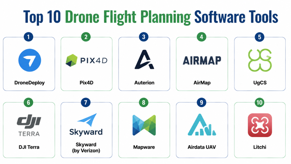
Top 10 Drone Flight Planning Software Tools
1- DroneDeploy
Short description: Cloud-based platform for mapping, inspection, and surveying with automated flight planning and data analytics.
Key Features
- Automated route planning
- Real-time telemetry
- AI-powered orthomosaic maps
- Multi-drone coordination
- Sensor integration (RGB, thermal)
- Cloud analytics and reporting
Pros
- Easy-to-use interface for operators
- Advanced analytics for agriculture and construction
- Strong cloud-based collaboration features
Cons
- Subscription cost can be high for small teams
- Limited offline planning features
Platforms / Deployment
- Web / iOS / Android
- Cloud
Security & Compliance
- Not publicly stated
Integrations & Ecosystem
Integrates with GIS software, CAD tools, and sensor platforms.
- GIS & CAD connectors
- Camera and LiDAR integration
- API for custom workflows
Support & Community
- Training, documentation, support portal, active user community
2- Pix4D
Short description: Professional drone mapping software with automated flight and photogrammetry tools for survey, construction, and agriculture.
Key Features
- Automated flight missions
- Photogrammetry processing
- 3D modeling and orthomosaics
- Multi-drone flight support
- AI-assisted data analysis
- Cloud and desktop processing
Pros
- Accurate mapping and surveying outputs
- Supports multiple sensor types
- Flexible cloud and desktop workflows
Cons
- Steeper learning curve
- High-end features require subscription
Platforms / Deployment
- Windows / macOS / Web / iOS / Android
- Cloud / Desktop
Security & Compliance
- Not publicly stated
Integrations & Ecosystem
- GIS software
- Sensor integrations (LiDAR, RGB)
- API for workflow automation
Support & Community
- Documentation, tutorials, and support portal
3- Auterion
Short description: Enterprise drone software platform with open-source flight planning and fleet management for industrial operations.
Key Features
- Enterprise fleet management
- Open-source PX4 integration
- Automated mission planning
- Real-time monitoring
- Regulatory compliance tools
- Analytics dashboards
Pros
- Strong enterprise and industrial focus
- Open-source extensibility
Cons
- Requires technical expertise
- Smaller user community
Platforms / Deployment
- Web / iOS / Android
- Cloud / Hybrid
Security & Compliance
- Not publicly stated
Integrations & Ecosystem
- PX4 drones
- GIS and asset management tools
- API access
Support & Community
- Enterprise support, documentation, developer community
4- AirMap
Short description: Focused on regulatory compliance and airspace intelligence, AirMap supports BVLOS flight planning and drone fleet management.
Key Features
- Airspace awareness and geofencing
- Flight authorization and compliance
- Fleet management
- Real-time telemetry
- Cloud dashboards
- BVLOS planning
Pros
- Strong regulatory compliance tools
- Real-time monitoring and alerts
Cons
- Limited mapping and photogrammetry capabilities
- Requires internet connectivity
Platforms / Deployment
- Web / iOS / Android
- Cloud
Security & Compliance
- Not publicly stated
Integrations & Ecosystem
- Airspace databases
- GIS and drone platforms
- API access
Support & Community
- Documentation, support portal, community forum
5- UgCS
Short description: Universal ground control software for mission planning and 3D flight visualization across multiple drone brands.
Key Features
- 3D flight planning
- Multi-drone coordination
- Automated waypoint missions
- Terrain and obstacle modeling
- Mission simulation
- Sensor payload management
Pros
- Compatible with multiple drone brands
- Advanced 3D planning tools
Cons
- Desktop-focused
- Interface may be complex for beginners
Platforms / Deployment
- Windows / macOS
- On-premise / Cloud optional
Security & Compliance
- Not publicly stated
Integrations & Ecosystem
- Drone hardware APIs
- Camera and sensor integrations
- GIS data import
Support & Community
- Documentation, webinars, support forum
6- DJI Terra
Short description: DJI’s proprietary flight planning and mapping software for DJI drones, offering 2D/3D mapping and automated mission execution.
Key Features
- Automated flight planning
- 2D and 3D mapping
- Real-time telemetry
- Waypoint and grid missions
- AI-assisted data processing
- DJI hardware integration
Pros
- Seamless with DJI drones
- User-friendly interface
Cons
- Limited to DJI ecosystem
- Advanced analytics less flexible
Platforms / Deployment
- Windows
- Desktop / Cloud optional
Security & Compliance
- Not publicly stated
Integrations & Ecosystem
- DJI drones
- Sensor payloads
- Export to GIS and CAD
Support & Community
- DJI support, tutorials, documentation
7- Skyward (by Verizon)
Short description: Cloud-based drone operations management platform focused on enterprise compliance, flight planning, and analytics.
Key Features
- Automated flight planning
- Airspace compliance and approvals
- Fleet management
- Real-time monitoring
- Analytics and reporting
- Integration with enterprise software
Pros
- Enterprise-grade compliance
- Multi-drone fleet management
Cons
- Enterprise-focused; may be costly for small teams
- Limited photogrammetry tools
Platforms / Deployment
- Web / iOS / Android
- Cloud
Security & Compliance
- Not publicly stated
Integrations & Ecosystem
- GIS and CRM tools
- Enterprise analytics
- API for workflow automation
Support & Community
- Documentation, support portal, training
8- Mapware
Short description: Drone mission planning software for industrial inspection and surveying, emphasizing ease of use and automated flight.
Key Features
- Automated waypoint planning
- 3D visualization
- Sensor integration
- Real-time telemetry
- Cloud data storage
- Reporting dashboards
Pros
- Simple interface for field operators
- Quick mission setup
Cons
- Limited enterprise analytics
- Smaller community
Platforms / Deployment
- Web / iOS / Android
- Cloud
Security & Compliance
- Not publicly stated
Integrations & Ecosystem
- Drone sensors
- GIS data
- API for integration
Support & Community
- Documentation, email support
9- Airdata UAV
Short description: Flight data management platform for UAV fleets, focused on maintenance, analytics, and operational planning.
Key Features
- Flight logging and analytics
- Fleet monitoring
- Automated flight alerts
- Mission planning
- Compliance reporting
- Integration with DJI and other drones
Pros
- Excellent fleet monitoring
- Data-driven maintenance insights
Cons
- Less focused on mapping
- Primarily for DJI drones
Platforms / Deployment
- Web / iOS / Android
- Cloud
Security & Compliance
- Not publicly stated
Integrations & Ecosystem
- Drone telemetry data
- API for fleet management
- Export to GIS/CAD
Support & Community
- Documentation, support portal
10- Litchi
Short description: Consumer-focused flight planning app with waypoint missions, automated routes, and VR/FPV support.
Key Features
- Waypoint mission planning
- Grid and orbit patterns
- VR/FPV interface
- Camera integration
- Real-time telemetry
- Cloud backup
Pros
- User-friendly and mobile-friendly
- Good for hobbyists and small teams
Cons
- Limited enterprise analytics
- Supports fewer drone brands
Platforms / Deployment
- iOS / Android
- Cloud optional
Security & Compliance
- Not publicly stated
Integrations & Ecosystem
- DJI drones
- Camera integration
- Cloud backup
Support & Community
- Documentation, online tutorials, community forum
Comparison Table (Top 10)
| Tool Name | Best For | Platform(s) Supported | Deployment | Standout Feature | Public Rating |
|---|---|---|---|---|---|
| DroneDeploy | Mapping & inspections | Web / iOS / Android | Cloud | Automated flight planning | N/A |
| Pix4D | Survey & photogrammetry | Windows / macOS / Web / iOS | Cloud / Desktop | 3D modeling & orthomosaics | N/A |
| Auterion | Industrial fleets | Web / iOS / Android | Cloud / Hybrid | Open-source fleet management | N/A |
| AirMap | Compliance & BVLOS | Web / iOS / Android | Cloud | Airspace intelligence | N/A |
| UgCS | Multi-drone missions | Windows / macOS | On-premise / Cloud | 3D flight visualization | N/A |
| DJI Terra | DJI drones mapping | Windows | Desktop / Cloud | 2D/3D mapping | N/A |
| Skyward | Enterprise operations | Web / iOS / Android | Cloud | Compliance & fleet management | N/A |
| Mapware | Industrial inspections | Web / iOS / Android | Cloud | Automated mission setup | N/A |
| Airdata UAV | Fleet monitoring | Web / iOS / Android | Cloud | Data-driven maintenance | N/A |
| Litchi | Consumer missions | iOS / Android | Cloud optional | Mobile waypoint planning | N/A |
Evaluation & Scoring of Drone Flight Planning Software
| Tool Name | Core | Ease | Integrations | Security | Performance | Support | Value | Weighted Total |
|---|---|---|---|---|---|---|---|---|
| DroneDeploy | 9 | 8 | 8 | 7 | 9 | 8 | 7 | 8.2 |
| Pix4D | 9 | 7 | 8 | 7 | 9 | 7 | 7 | 8.0 |
| Auterion | 8 | 7 | 8 | 7 | 8 | 7 | 7 | 7.6 |
| AirMap | 7 | 8 | 7 | 8 | 8 | 7 | 7 | 7.6 |
| UgCS | 8 | 6 | 7 | 7 | 8 | 7 | 7 | 7.3 |
| DJI Terra | 8 | 8 | 6 | 7 | 8 | 7 | 7 | 7.4 |
| Skyward | 8 | 7 | 7 | 7 | 8 | 7 | 7 | 7.4 |
| Mapware | 7 | 8 | 6 | 7 | 7 | 7 | 7 | 7.1 |
| Airdata UAV | 7 | 7 | 7 | 7 | 7 | 7 | 7 | 7.0 |
| Litchi | 6 | 8 | 6 | 6 | 7 | 6 | 7 | 6.7 |
Interpretation: Weighted scores indicate overall suitability. Higher scores suggest better feature depth, ease of use, integrations, security, and value for small teams to enterprise operators.
Which Drone Flight Planning Software Is Right for You?
Solo / Freelancer
- Litchi or Mapware for small, mobile-focused missions or hobbyist operations.
SMB
- DroneDeploy or Pix4D for mapping, surveying, and inspection with moderate fleet sizes.
Mid-Market
- DJI Terra, AirMap, or UgCS for automated missions and multi-drone operations.
Enterprise
- Auterion or Skyward for large-scale fleet management, BVLOS operations, and compliance monitoring.
Budget vs Premium
- Open-source or mobile-first apps for low budgets; premium cloud platforms offer fleet coordination, AI features, and analytics.
Feature Depth vs Ease of Use
- Pix4D and DroneDeploy provide deep analytics; Litchi and Mapware emphasize simplicity and mobile usability.
Integrations & Scalability
- Enterprises should prioritize platforms with APIs, GIS integration, and cloud-based scalability.
Security & Compliance Needs
- Choose platforms with secure access, audit logs, and airspace compliance tools for enterprise or regulated operations.
Frequently Asked Questions (FAQs)
1- What types of drones are supported?
Most software supports DJI, PX4, and other commercial UAVs. Enterprise platforms support multi-drone fleets.
2- Can I automate missions?
Yes, most platforms allow waypoint, grid, and orbit missions with automated execution.
3- Are AI features included?
Some platforms offer AI for obstacle detection, route optimization, and analytics, primarily in premium or enterprise versions.
4- How do I comply with airspace regulations?
Platforms like AirMap and Skyward provide geofencing, no-fly zone alerts, and regulatory approval workflows.
5- Is cloud processing required?
Not always; some platforms like UgCS or DJI Terra can run locally, while others are cloud-native.
6- Can these tools integrate with sensors?
Yes, RGB cameras, LiDAR, thermal, and multispectral sensors are commonly supported.
7- How scalable are these platforms?
Enterprise solutions handle multi-drone fleets; mobile apps are better suited for single or small teams.
8- Can I export mapping data?
Most platforms support common GIS formats, 3D models, and orthomosaics for analysis and reporting.
9- Are these tools beginner-friendly?
Litchi and Mapware are intuitive; platforms like Pix4D or Auterion require training.
10- What’s the cost structure?
Options include subscription, pay-per-flight, or enterprise licenses. Open-source and hobbyist apps may be free or low-cost.
Conclusion
Drone Flight Planning Software enables efficient, safe, and compliant UAV operations. Solo users may prefer mobile apps like Litchi, SMBs can benefit from DroneDeploy or Pix4D, while mid-market and enterprises gain the most from Auterion, Skyward, or DJI Terra. Next steps: shortlist 2–3 platforms aligned with your drone operations, run pilot missions, validate integration with sensors and fleet management, and assess AI-driven optimization.