Udyavara River
Udyavara River |
About: |

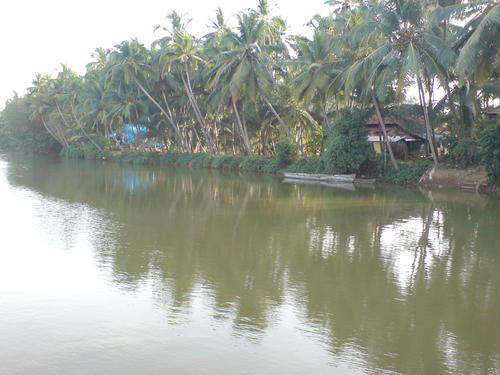
The Udyavara River, also known as the Udyavara Hole, is a serene river flowing through the Udupi district in Karnataka, India. The river holds cultural, ecological, and economic importance in the region. Known for its tranquil backwaters and rich biodiversity, the Udyavara River is an essential part of the local ecosystem and a scenic attraction for visitors. The important temples of Udyavara are Siddivinayaka temple, Durgaparameshwari temple and the Shambushaileshwara temple. Udyavara is a small village situated 4km away from Udupi Town which is a very famous for its Shri Krishna Math Udyavara also very famous for its temple It consista of Vinayaka Temple, Veera Vittala Temple, Pade Devastana, etc |
Location info: |
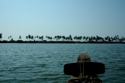
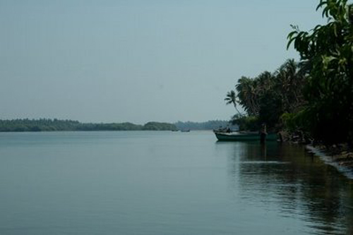
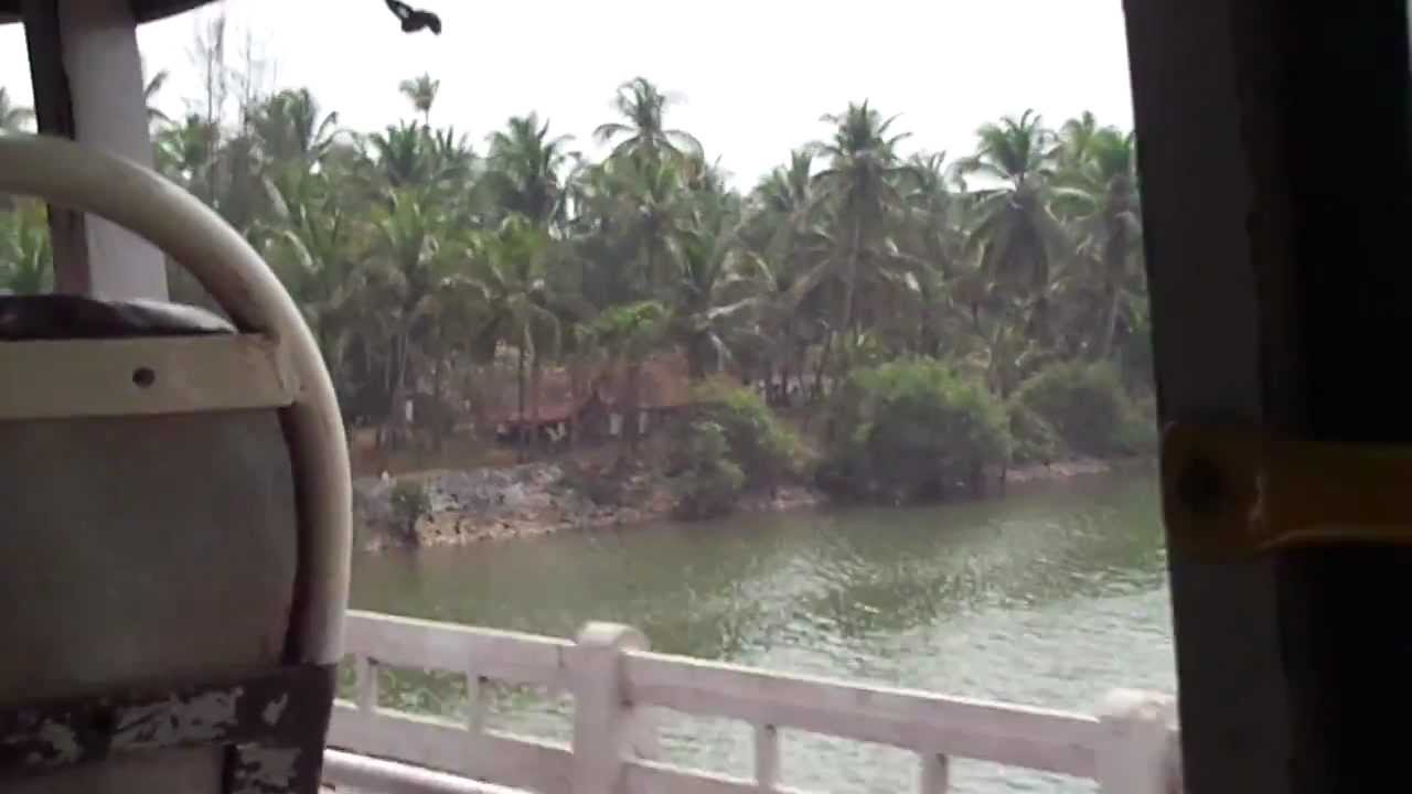
| The Udyavara River flows through the Udupi district, Karnataka, near the coastal town of Udyavara and ultimately empties into the Arabian Sea. The river runs parallel to the coastline, creating beautiful backwater stretches, mangrove forests, and sandbanks along its path. |
Climate/Weather: |
| Summer (March-May): Warm and humid, with temperatures ranging from 25°C to 35°C.
Monsoon (June-September): Experiences heavy rainfall due to the southwest
monsoon, causing the river to swell and the surroundings to become lush and
green.
Winter (October-February): Pleasant and cool, with temperatures between 20°C and
28°C, making it an ideal time for visiting.
|
History: |
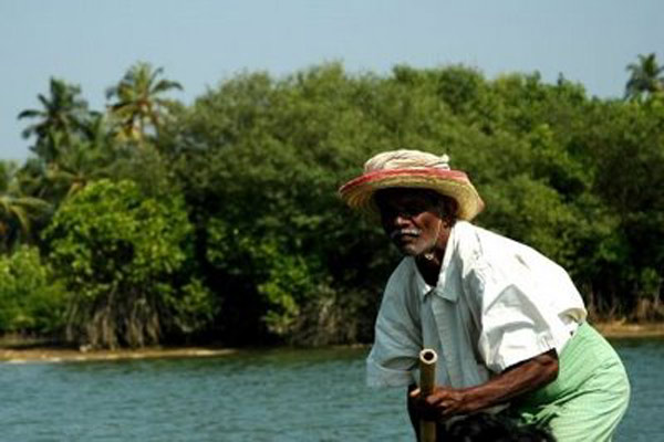
| The Udyavara River has historically been significant to the people of Udupi, supporting agriculture, fishing, and transportation. The town of Udyavara itself has historical roots dating back to ancient times, with cultural influences from Hindu and Jain communities. The river has also been used for traditional boat racing events and continues to play a role in local festivals and customs. |
Interesting things to do: |
|
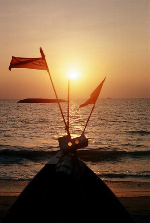
Backwater Boating: Enjoy a peaceful boat ride along the river’s backwaters, exploring mangroves, sandbanks, and scenic river stretches. Fishing and Angling: The river supports local fish species, making it a popular spot for recreational fishing and angling. Bird Watching: The river and nearby estuarine environment attract various bird species, making it an ideal spot for bird watching and photography. Photography: Capture stunning views of the backwaters, especially at sunrise and sunset, as the river reflects the golden hues beautifully. |
Interesting things to Visit: |
|
Malpe Beach: Located nearby, Malpe Beach is a popular coastal attraction known for its sandy shores, water sports, and sunset views. St. Mary’s Island: Accessible from Malpe Beach by boat, these unique islands are known for their basalt rock formations and scenic coastal beauty. Udupi Sri Krishna Temple: A renowned Hindu temple dedicated to Lord Krishna, located in Udupi town, a short drive from the river. Kapu Lighthouse: Located near the river’s estuary, the Kapu Lighthouse offers panoramic views of the Arabian Sea and the surrounding coastal landscape.. ☀ Someshwara Wildlife Sanctuary: About 40 km from Udupi. It contains
rare species of animals, birds and medicinal plants. |
Mobile range info: |
| Mobile network coverage is generally good around Udyavara town and Udupi, with most major network providers available. However, some areas along the riverbanks may have limited connectivity due to the dense mangroves and rural settings. |
How to reach? |
| Nearest Railway Station: Udupi Railway Station, located approximately 10 km from the river, is well-connected to major cities in Karnataka and neighboring states. |
| Nearest Airport:The nearest airport is Mangalore International Airport, about 65 km from Udyavara.. |
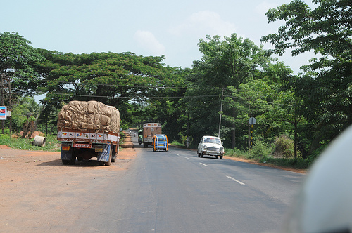
| Road Transport: Udyavara is well-connected by road to Udupi and Mangalore, with regular buses and taxis available for local transportation. |
Nearest Visiting places: |
| Udupi: A cultural and religious town known for its Krishna Temple, beautiful beaches, and coastal charm. Mangalore: Located around 60 km south, Mangalore offers attractions like the Kadri Manjunath Temple, Mangaladevi Temple, and Tannirbavi Beach. Manipal: Known for its educational institutions, Manipal also offers scenic viewpoints and peaceful surroundings, just a short drive from Udupi. |
Nearest Petrol Pump: |
| Petrol pumps are available in Udyavara town and nearby Udupi, making it easy to refuel before exploring the river and its surroundings. |
Hotels/Lodge/Accommodation: |
| Hotels in Udupi: Various budget and mid-range hotels are available in Udupi, catering to different traveler needs. Beach Resorts: For a more scenic stay, beach resorts near Malpe Beach offer beautiful ocean views. Homestays in Udyavara and Udupi: There are also homestay options available, allowing visitors to experience local hospitality. |
Things to carry: |
| Comfortable clothing and footwear suitable for outdoor activities and exploration. Sun protection, including sunglasses, a hat, and sunscreen, especially if spending time near the river. Water bottle and snacks, as food options may be limited near the river. Camera or binoculars for capturing scenic views and bird watching. Personal essentials and any necessary medications. |
Tips & Suggestions: |
| Visit during the winter for the best weather, as the river is most serene and accessible during this time. Follow local guidelines if boating or fishing, and ensure proper safety precautions. Respect the natural environment, particularly near mangroves and estuaries, which are fragile ecosystems. If planning to visit nearby beaches or the lighthouse, carry a change of clothes and extra footwear. Avoid littering along the riverbanks to help preserve the pristine environment. |
Help Line/Phone Number: |
| Karnataka Tourism Helpline 080-2235-2828 |
| Local Police Station (Udupi): +91-820-252-0400 |


Udyavara River Nearest Attraction |
| St. Mary's Island |
| Located 58 km north of Mangalore, the St. Mary's Island beach is special for the unique formation of basalt rocks which have crystallized into columns and split into vertical hexagonal blocks. This group of islands is accessible by ferry from Malpe which is a major fishing harbor.....more |
| Kollur Temples |
| Kollur Mookambika Temple, an important seat of Shakti worship is located in very picturesque surroundings at the foot of the Western Ghats in Kundapur taluk of Udupi district. This sacred place is situated on the banks of river sauparnika and surrounded by thickly wooded hills and has a natural formation resembling the Sri Chakra. Kollur is one of the seven mukti places which were created by Parashurama.....more |
| Udupi Temples |
| Udupi, the Kokani city is the headquarters of the Udupi District, Karnataka State, India. When one hears the name "Udupi" either "Udupi Krishna" or "Udupi Masala Dosa" comes to the mind. Of course the famous, Krishna temple is located in this city. The temple is famous for a unique statue of Lord Krishna.....more |
| Kollur Forest |
| Kollur is a tiny hamlet situated 40km Kundapur Town, about 140 km away from Mangalore City in Karnataka state in Southern part of India. This village lies at the foot of the Western Ghats, and is famous for the Mookambika temple, a Hindu pilgrim center.....more |
| Mookambika Wildlife Sanctuary |
| Located in Udupi District, Karnataka, Mookambika Wildlife Sanctuary spans over 247 sq km and is thick with evergreen, semi-evergreen and moist deciduous forests of the Western Ghats, and small patches of teak plantations. It is contiguous with the Sharavathi Valley Wildlife Sanctuary.....more |
| Someshwara Wildlife Sanctuary |
| Located in the Western Ghats, Someshwara Wildlife Sanctuary in Udupi District of Karnataka. This 88 sq km sanctuary is consists of semi-evergreen and evergreen forests. Wildlife species include tiger, leopard, wild dog, jackal, gaur, wild pig, sambar deer, spotted deer, barking deer, lion tailed macaque, bonnet macaque and common langur.....more |
| Karkala |
| Karkala is a town and also the headquarters of Karkala Taluk in Udupi district of Karnataka, India, and is located about 300 km from Bangalore. It lies near the Western Ghats. The first name of this town was Pandya Nagari during the Jain regime but afterwards it was changed to Karikallu because of black stones.....more |
| Koosalli Falls |
| The fabulous picnic spot, Koosalli waterfalls is located near Koosalli village in Kundapura. A series of six falls, one above the other, in splendid surroundings makes it one of the best waterfalls in the state. The combined height of all six falls is about 380 ft....more |
| Gurupura or Phalguni River |
| Gurupura river flows through Gurupura, Mangalore, Tannirubhavi. It joins the Arabian sea near Tannir bhavi. is the chief port city of the Indian state of Karnataka. Bounded by the Arabian Sea and the Western Ghat mountain ranges, Mangalore is the administrative headquarters of the Dakshina Kannada (formerly South Canara) district in southwestern Karnataka.....more |
| Kedaka River |
| The Kedaka River is a river flowing through Kundapur and Gungulli in western India. It joins with the Souparnika River, Varahi River, Chakra River, and Kubja River and merges into the Arabian Sea.....more |
| Pangala River |
| Pangala is a village situated in Udupi taluk of Udupi district, Karnataka. India's National Highway number 17 (NH-17) road connecting Mangalore (Kudla or Mangaluru) to Mumbai (Bombay) passes through this village.The village is on the north banks of Pangala river.....more |
| Souparnika River |
| Souparnika River is a river flowing through Kundapur and Gangolli in western India. It joins with the Varahi River, Kedaka River, Chakra River, and Kubja River and merges into the Arabian Sea.Sauparnika is a sacred river which emerges from a verdant mountain near Maravanthe in Udupi District of Karnataka.....more |
| Kaup Beach |
| Kaup Beach is located 12 km south of Udupi. It is situated on the coastal belt. The Kaup beach is one of the most beautiful beaches. Its placement is perfect. The beach with the 100 ft high lighthouse on the rocks is a photographer's paradise.....more |
| Malpe Beach |
| About 6 kms from Udupi, in South Canara is Malpe, an ideal picnic spot with its virgin beach. The endless stretch of golden sand, graciously swaying palm trees, the clear blue sky and the gurgle of the sea all set a perfect mood for an unforgettable holiday here....more |
| Trasi Beach |
|
Trasi is a beautiful place on the west coast of India, 100 km from Mangalore, 900 km from Mumbai and 12 km north from Kundapur.Here you can see a unique scene where a National highway separates the Arabian sea from the Sauparnika river.....more |
| Panna Island |
| ....more |
| Kudumari Falls |
| ....more |
| Seeta/ Seetha falls / Koodlu Theertha falls / Sita falls |
| ....more |
SELECT YOUR HOLIDAY DESTINATION
-
Aero Sports in Karnataka
-
Archaeology in Karnataka
-
Beaches in Karnataka
-
Bird Sanctuaries in Karnataka
-
Bouldering Spot in Karnataka
-
Camping in Karnataka
-
Cave Explorations in Karnataka
-
Culturals Place in Karnataka
-
Dams in Karnataka
-
Districts Of Karnataka
-
Fairs in Karnataka
-
Festivals in Karnataka
-
Go-Karting in Karnataka
-
Hill Stations in Karnataka
-
Historical Places in Karnataka
-
Holiday Resorts in Karnataka
-
Islands in Karnataka
-
Landscape in Karnataka
-
Mountain Biking in Karnataka
-
National Parks in Karnataka
-
Orbit Network
-
Pilgrims Destinations
-
Para-sailing in Karnataka
-
River rafting in Karnataka
-
Rivers in Karnataka
-
Rock Climbing in Karnataka
-
Safari in Karnataka
-
Temples in Karnataka
-
Trekking in Karnataka
-
Water Sports in Karnataka
-
Waterfalls in Karnataka
-
Wildlife Sanctuaries in Karnataka