Varahi River
Varahi River |
About: |

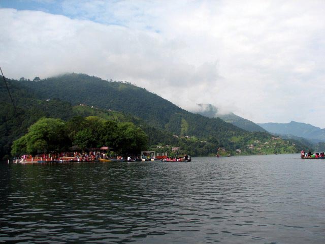
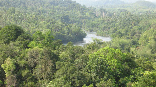
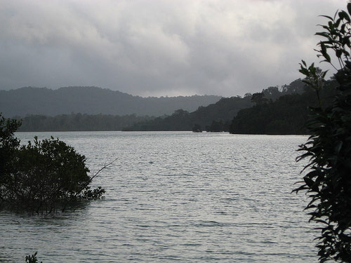
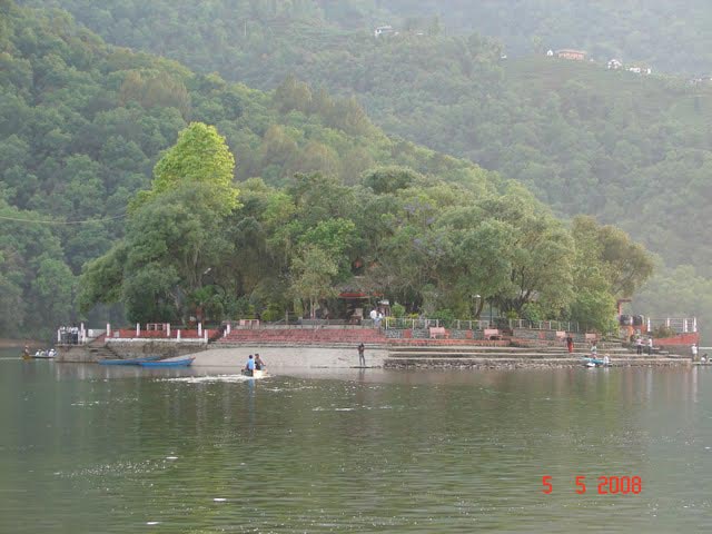
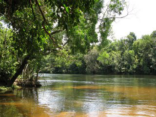
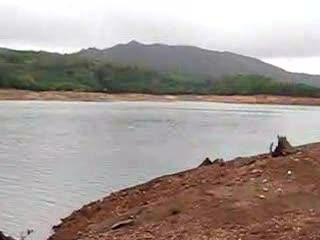
The Varahi River is a picturesque river originating in the Western Ghats in Karnataka, India. Known for its tranquil beauty and flowing through lush forests, the river is a significant part of the local ecosystem and supports many communities and species along its course. The river eventually joins the Arabian Sea, after flowing through numerous towns and villages, and is essential for local agriculture and irrigation. About Simoga:Shimoga is locally called as Shiva-mogga. The name shimoga is derived from the term Shiva-Mukha, literally meaning "Face of Shiva". Shimoga District is a part of naturally rich Malnad (Malenaadu) region of Karnataka. Shimoga is a true picture of nature's bounty-landscapes dotted with waterfalls, swaying palms and lush paddy fields make for picturesque locales. Shimoga is 273 kms southwest of Bangalore. Shimoga district is bounded by the districts of Chikmagalur to the southeast, Davanagere to the east, Haveri to the northeast, Udupi to the southwest, and North Canara (Uttara Kannada) to the northwest. Shimoga district is also known as the Rice Bowl of Karnataka state. |
Location info: |
| The Varahi River flows through the Udupi district in Karnataka, with its origins near Agumbe, a location known for its heavy rainfall and dense forests. This area is a biodiversity hotspot in the Western Ghats and provides stunning natural scenery. |
Climate/Weather: |
| Summer: (March to May) – Warm and humid, with temperatures ranging from 25°C to 35°C. Monsoon: (June to September) – Receives heavy rainfall, particularly near the source in Agumbe, which can lead to swollen river levels. Winter: (November to February) – Mild and pleasant, with temperatures ranging from 18°C to 28°C, ideal for visiting. |
History: |
| The Varahi River holds cultural significance for local communities and is associated with regional folklore. The surrounding forests and river basin have been inhabited by various communities, and the river has historically been crucial for agriculture, fishing, and water resources. |
Interesting things to do: |
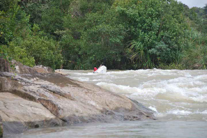
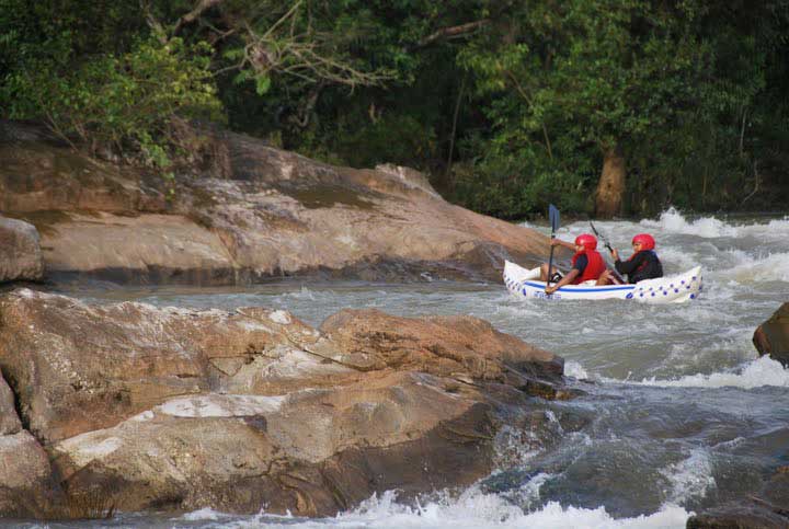
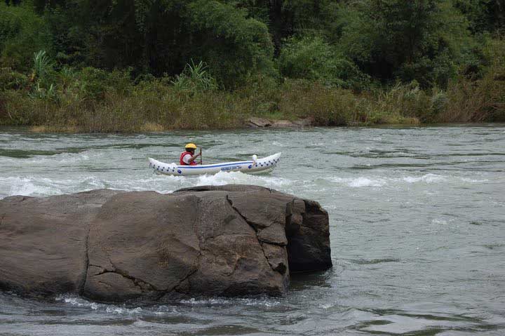
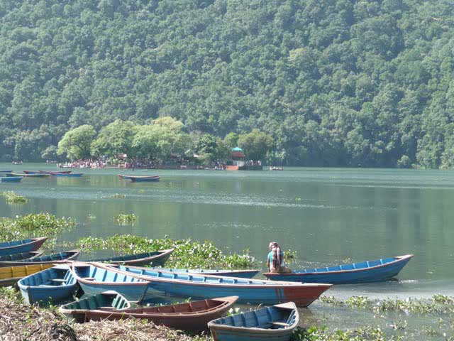
| River Rafting: During certain seasons, rafting is available in sections of the Varahi, offering an adventurous way to explore its waters. Photography and Bird Watching: The lush surroundings make it a haven for photographers and birdwatchers. Trekking: Trails around the Varahi River lead through scenic landscapes in the Western Ghats, ideal for trekkers. |
Interesting things to Visit: |
| Agumbe Sunset View Point: Known for breathtaking sunset views, especially during
the monsoon.
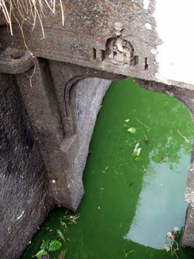
Varahi Underground Powerhouse: A unique hydroelectric project with an
underground powerhouse, offering educational tours.
Kundadri Hills: Known for its ancient Jain temple and panoramic views of the
Western Ghats.
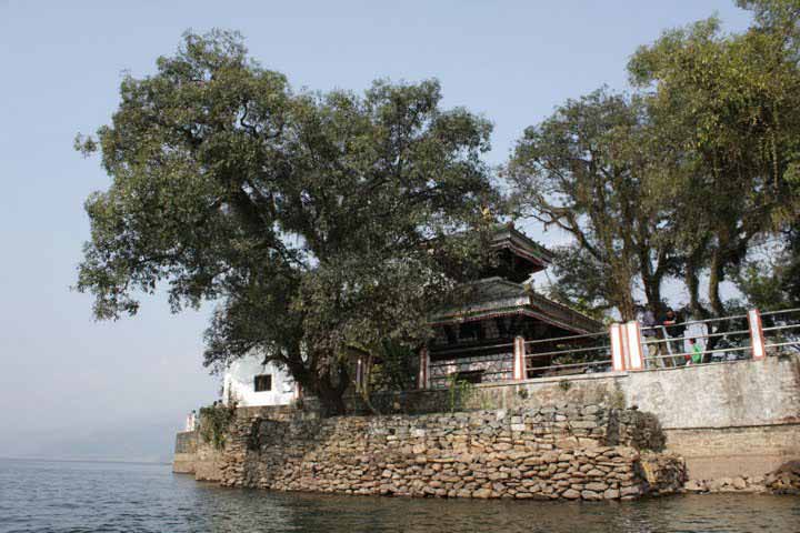
# Sri Vinayaka (Ganesh) Temple at Anegudde, between Kota and Koteshwar towns. (5 k.m. from Kundapura) The area where the temple stands is called Kumbhashi. Among the several temples in Kumbhashi Anegudde, Sri Vinayaka Temple is the oldest, and it is also the most popular in this region. This Ganesh temple is on a small hillock, giving the name Anegudde, "Ane" meaning elephant and "Gudde" meaning a hillock (in kannada). |
Mobile range info: |
| Mobile networks are generally available in Udupi and surrounding areas, but reception may be limited as you move deeper into the forested regions around the river. |
How to reach? |
| Nearest Railway Station:Kundapur is also connected by Konkan Railway which runs through Mumbai, Mangalore. Kundapur Railway station is about 4 km from town. |
| Nearest Airport:The nearest air port is Mangalore Situated around 100 km from kundapur. |
| Road Transport:Accessible via well-connected road networks from major towns and cities in Karnataka. State buses and private vehicles are commonly used. |
Nearest Visiting places: |
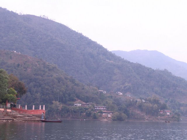
1. Kundapur: Known for its beautiful coastal views and cultural heritage. 2. Malpe Beach: A popular beach destination with water sports. 3. Kodachadri: This is the highest peak in Shimoga District. Kodachadri is around 120 kms from Shimoga this beautiful hill station is nestled in the Western Ghats. The famous Kollur is 12 Kms away from Kodachadri. |
Nearest Petrol Pump: |
| Petrol pumps are available along major highways leading to Udupi and within Udupi town. |
Hotels/Lodge/Accommodation: |
| Udupi: Multiple accommodations available, including budget lodges, mid-range hotels, and luxury options. Agumbe: Limited options, primarily homestays and small lodges. |
Things to carry: |
| Comfortable walking shoes Insect repellent and sunscreen First-aid kit Light rain jacket (especially if visiting during the monsoon) Water bottle and snacks |
Tips & Suggestions: |
| Respect local customs and traditions, especially near temples and cultural sites. During the monsoon, check the river levels, as some areas may be unsafe for water activities. Hire a local guide if planning a trek or exploring forested areas. |
Help Line/Phone Number: |
| Karnataka Tourist Information: +91-80-2235-2828 |
Varahi River Nearest Attraction |
| Agumbe Hillstation |
| Agumbe, a small village located in Karnataka for all those who wish to find peace with nature in the western ghats. It is known to be the wettest region in Karnataka receiving highest rainfall. The tiny village is much known for its beautiful sunset and the trek opportunities it offer.....more |
| Sharavathi Valley Wildlife Sanctuary |
| Located in Shimoga District, Sharavathi Valley Wildlife Sanctuary spans over 431 sq km. Apart from the area occupied by the Liganamakki Reservoir or Honnemaradu, the sanctuary is divided into core zone, buffer zone and tourism zone.....more |
| Shettihalli Wildlife Sanctuary |
| Shettihalli Wildlife Sanctuary is located in Shimoga District of Karnataka. It spreads over 395 sq km of tropical evergreen and semi-evergreen forests. The sanctuary is inhabited by tiger, leopard, wild dog, jackal, gaur, elephant, sloth bear, sambar deer, spotted deer, wild pig,....more |
| Ikkeri Archeology |
| Ikkeri is situated in Shimoga district of Karnataka state at about 3 km to the south of Sagar. The word Ikkeri in Kannada means "Two Streets". This place was the capital of Keladi Nayakas for some years....more |
| Keladi |
| Keladi is 10 km away from Ikkeri and was the Nayaka capital. You enter the precincts with its several small shrines through a long-roofed wooden entrance.....more |
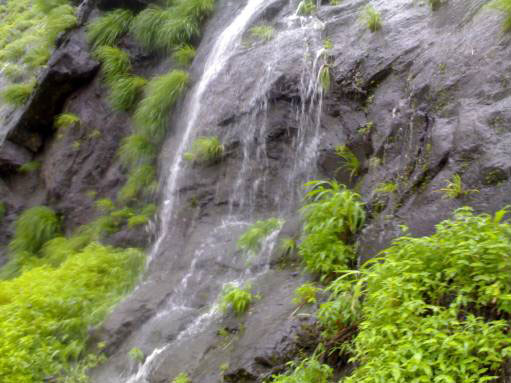
| Barkana Falls |
| Barkana Falls are among the ten highest waterfalls in India. They are located near Agumbe in Shimoga district of state of Karnataka. Barkana falls are formed by Sita river. Currently Barkana falls are the prime source of one of the hydro electric projects in Karnataka.....more |
| Honnemaradu Falls |
| Honnemaradu, the village, having been engulfed in the mid-1960s by the Liganamakki dam, has been literally resurrected today. This haven for water sport enthusiasts, tucked away in the lush greenery of the Western Ghats, is in the Shimoga District in north-west Karnataka, about 25 km from Sagar town on the way to Jog Falls.....more |
| Jog WaterFalls |
| The tallest and no doubt the most impressive waterfall in India, the Jog Falls(also known as the Gerusoppa waterfalls) is located about 400 kms from Bangalore in Karnataka. It is created by the Sharavathi River which comes down in cascades from a height of 292 meters at Gerusoppa in four distinct falls, called the Raja, Rani, Rover and Rocket.....more |
| Kunchikal Falls |
| Kunchikal Falls are the highest waterfalls in India and second highest waterfalls in Asia. They are located near Agumbe in Shimoga district of state of Karnataka. Kumchikal falls are formed by Varahi river. Currently Kunchikal falls are the prime source of one of the hydro electric projects in Karnataka.....more |
| Dandavathi River |
| Dandavathi is a river that flows in Sorab, India. It originates near Kuppe (Sorab taluk) and ends in the Varada river near Sagar. Sorab's Sri Ranganatha temple is built on the bay of the Dandavathi river.....more |
| Sharavathi River |
| Sharavathi is a river which originates and flows entirely within the state of Karnataka in India. It is one of the few westward flowing rivers of India and a major part of the river basin lies in the Western Ghats. The famous Jog Falls are formed by this river.....more |
| Varada river |
| Varada River, the only source of water for the Sagar town, is the major river of Shimoga District. Sagar is an industrial town in the heart of the Western Ghats, Sagar is located in Shimoga District of Karnataka. It is 75 km north-west of Shimoga.....more |
| Gudavi Bird Sanctuary |
| Sorab taluk of Shimoga district, comes alive in June as the energetic chirping of birds fills the air. The tree-lined banks of the Gudavi Lake become a brilliant mosaic of colours, with branches buried under bright plumage.....more |
| Mandagadde Bird Sanctuary |
| The Mandagadde Bird Sanctuary is situated in the Malenaadu region under the Shimoga district, towards Theerthahalli in Karnataka. The Mandagadde Bird Sanctuary has a spectacular collection of migratory birds.....more |
| Gajanur Dam |
| Gajanur is a village 12 km from Shivamogga in the Shivamogga District of Karnataka, India. The Tunga River flows through the village. Gajanur is well known for the dam built across the river.....more |
| Linganamakki dam |
| The Linganamakki dam was constructed by the Karnataka State Government in 1964. Located in the Sagara taluk, the dam has a length of 2.4 km, stretching across the Sharavathi river. It is located about 6 km from Jog Falls....more |
| Tunga Anicut Dam |
| Situiated 15 km from Shimoga, this dam was built across the river Tungabadra. You can enjoy boat trips around the lake. Situated around 15 Km from Shimoga, Tunga Anicut Dam is a popular choice for picnic among the locales.....more |
| Nagar |
| ....more |
| Humbucha |
| ....more |
SELECT YOUR HOLIDAY DESTINATION
-
Aero Sports in Karnataka
-
Archaeology in Karnataka
-
Beaches in Karnataka
-
Bird Sanctuaries in Karnataka
-
Bouldering Spot in Karnataka
-
Camping in Karnataka
-
Cave Explorations in Karnataka
-
Culturals Place in Karnataka
-
Dams in Karnataka
-
Districts Of Karnataka
-
Fairs in Karnataka
-
Festivals in Karnataka
-
Go-Karting in Karnataka
-
Hill Stations in Karnataka
-
Historical Places in Karnataka
-
Holiday Resorts in Karnataka
-
Islands in Karnataka
-
Landscape in Karnataka
-
Mountain Biking in Karnataka
-
National Parks in Karnataka
-
Orbit Network
-
Pilgrims Destinations
-
Para-sailing in Karnataka
-
River rafting in Karnataka
-
Rivers in Karnataka
-
Rock Climbing in Karnataka
-
Safari in Karnataka
-
Temples in Karnataka
-
Trekking in Karnataka
-
Water Sports in Karnataka
-
Waterfalls in Karnataka
-
Wildlife Sanctuaries in Karnataka