Sharavathi River
Sharavathi River |
About: |

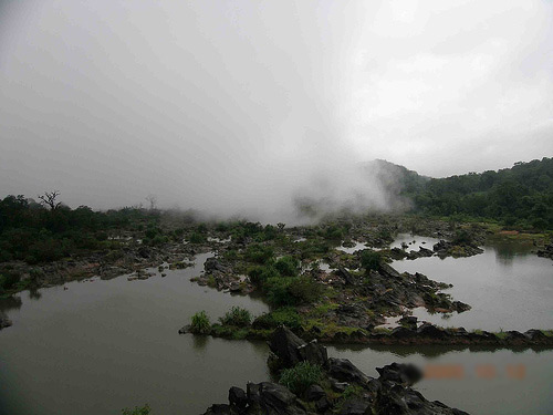
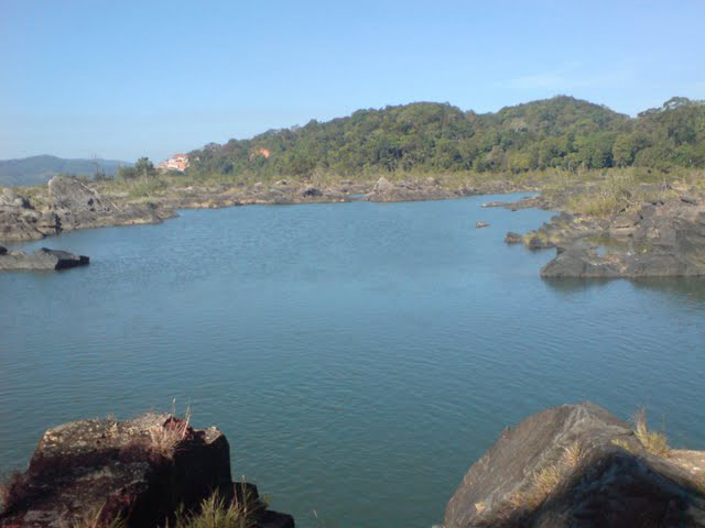
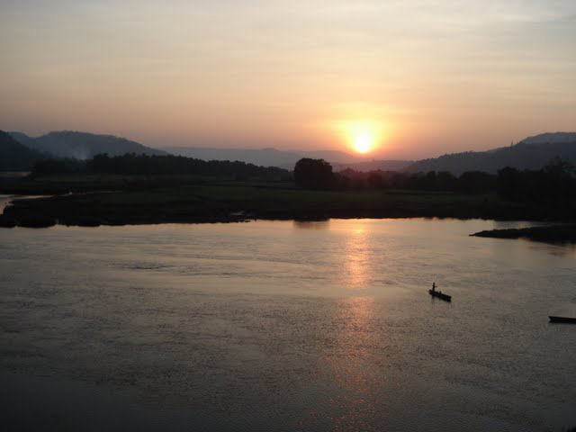
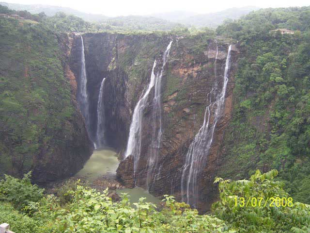
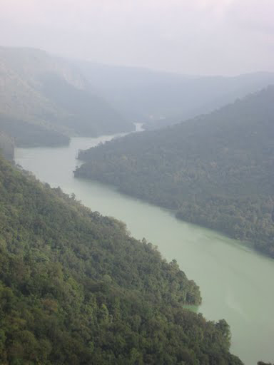
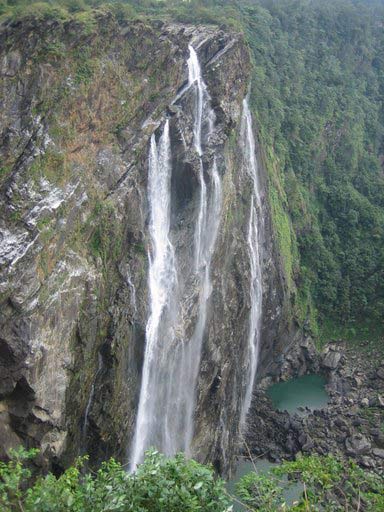
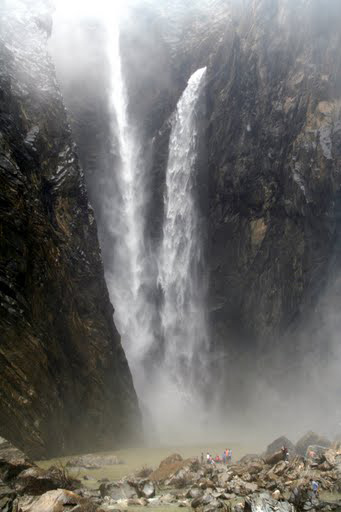
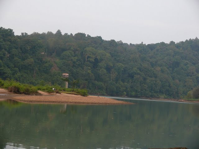
The Sharavathi River is one of the major rivers in Karnataka, known for its stunning waterfalls, lush forests, and rich biodiversity. Flowing through the Western Ghats, it originates near Ambutheertha in the Shivamogga district and travels approximately 128 kilometers before meeting the Arabian Sea at Honnavar. The river is particularly famous for the Jog Falls, one of the highest waterfalls in India, which cascades from a height of about 830 feet. The Sharavathi River basin is home to a variety of flora and fauna, making it a favored destination for nature lovers, birdwatchers, and adventure seekers. The river also serves as a crucial water source for the region, supporting hydroelectric power generation and irrigation, impacting both the environment and the local economy. The river basin mainly consists of Pre-Cambrian rocks. The two major groups
of rocks found in the Sharavathi river basin are the Dharwar system and the
peninsular gneiss. |
Location info: |
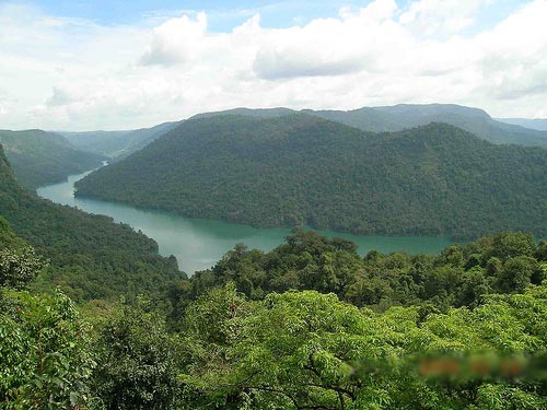
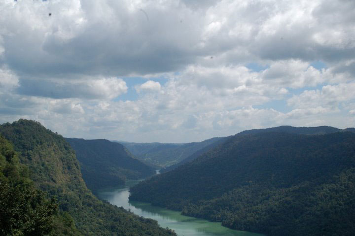
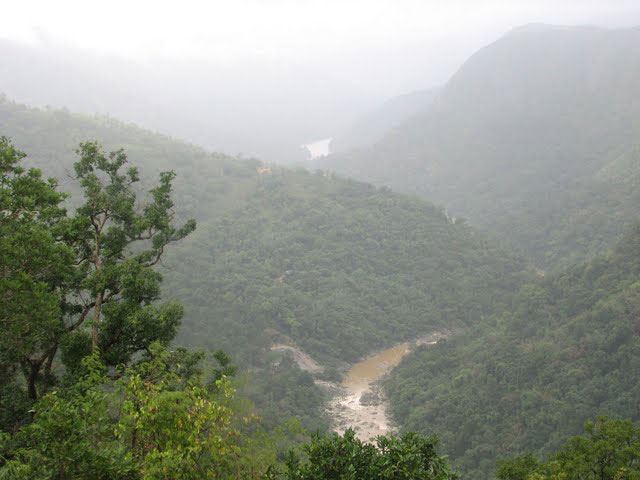
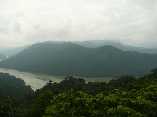
| The Sharavathi River flows through the Shivamogga and Uttara Kannada districts in Karnataka. Its journey through the Western Ghats offers a landscape rich in natural beauty, from dense forests to cascading waterfalls. Key landmarks along its course include Jog Falls and the Sharavathi Valley Wildlife Sanctuary. |
Climate/Weather: |
| The region around the Sharavathi River experiences a tropical climate with hot,
humid summers and cool, moderate winters. The best time to visit is from October
to March when the weather is more pleasant, with temperatures ranging between
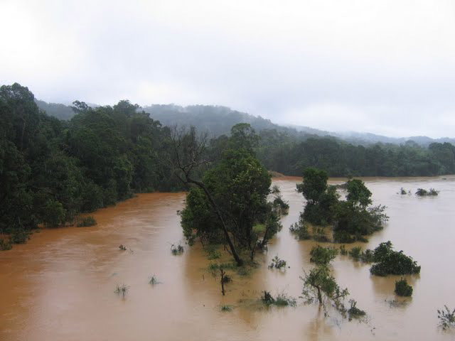
20°C to 30°C. Monsoon season (June-September) brings heavy rainfall, creating a
lush environment but making some areas challenging to access.
Temperature:-April is usually the hottest month with the mean daily maximum
temperature at 35.8oC and the mean daily minimum at 22.2oC.[2]
|
History: |
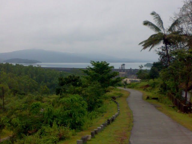
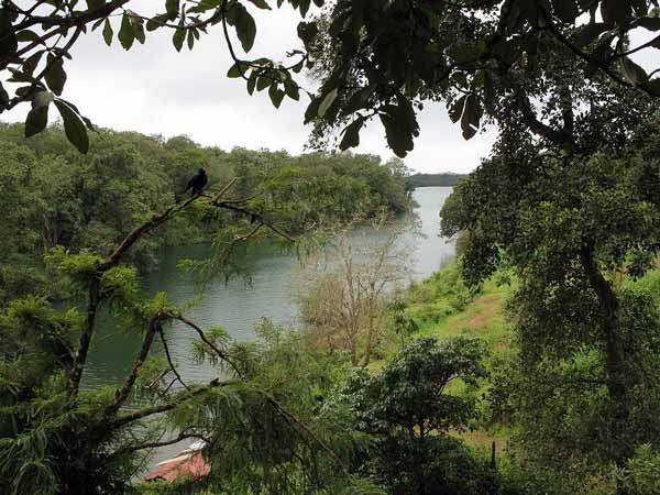
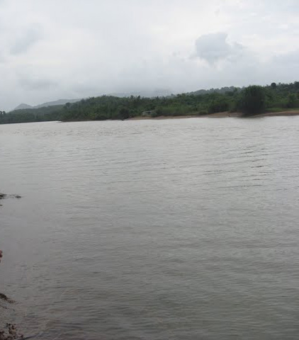
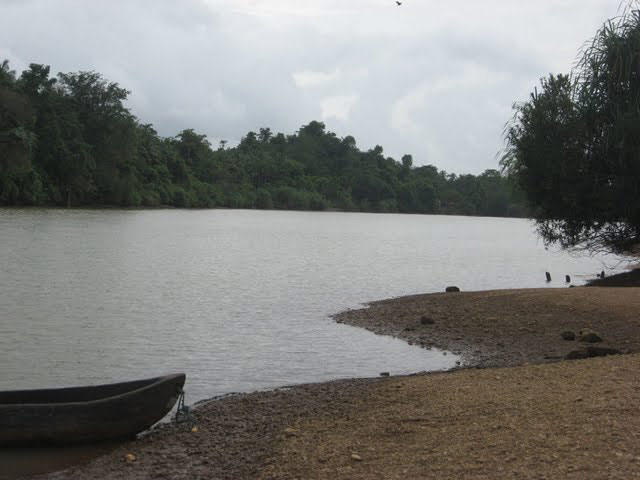
| Historically, the Sharavathi River region has been of cultural and ecological significance. Jog Falls, in particular, is referenced in ancient Kannada literature and has been a popular pilgrimage site. In the 1960s, the river was dammed to create the Linganamakki Reservoir, one of India’s largest reservoirs, which powers the Sharavathi Hydroelectric Project. |
Interesting things to do: |
| Trekking: Explore trails around the Sharavathi Valley for scenic views and biodiversity. Birdwatching: The region is ideal for spotting a variety of native bird species, especially around the Sharavathi Wildlife Sanctuary. Photography: Capture the grandeur of Jog Falls, scenic landscapes, and wildlife. Boating: Enjoy peaceful boat rides on the Linganamakki Reservoir. Wildlife Safaris: Embark on safaris to observe animals like elephants, leopards, and langurs in their natural habitat. |
Interesting things to Visit: |
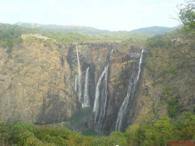
| Jog Falls: The major attraction along the Sharavathi River, known for its
impressive height and seasonal flow.
Linganamakki Dam: A significant dam built across the Sharavathi, creating one of
the largest reservoirs in Karnataka.
Sharavathi Valley Wildlife Sanctuary: A protected area offering lush greenery
and abundant wildlife.
Honnemaradu: A small island in the Linganamakki Reservoir, popular for camping
and water sports.
* Batasio sharavatiensis: A bagrid catfish discovered near Jog Falls, Uttara
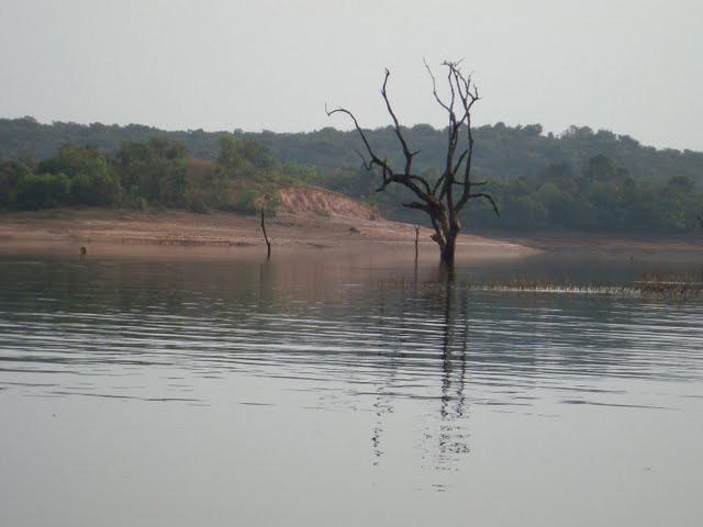
Kannada district. Sharavathi Valley Wildlife Sanctuary:- A part of the Sharavathi river basin was declared as a wildlife sanctuary on 20 April 1972.[8] Spread over an area of 431.23 km2., it has dense evergreen and semi-evergreen forests. Linganamakki reservoir spread over an area of 128.7 km2. is a part of this sanctuary. The remaining area has been divided into core zone (74.33 km2.), buffer zone (170.67 km2) and tourism zone (57.53 km2.).[8] The altitude in the sanctuary varies from 94 to 1102 mts, the highest point being Devarakonda on the southern edge of the sanctuary. Temperatures range from 15° to 38 °C and mean annual rainfall is 4500 mm. |
Mobile range info: |
| Mobile connectivity is generally available but may be limited in dense forested areas. It is advisable to check with your service provider. |
How to reach? |
| Nearest Railway Station: Talaguppa is the nearest railway station, around 16 km from Jog Falls. Shivamogga railway station, 105 km away, is also a major hub. |
| Nearest Airport:The nearest airport is Mangalore International Airport, about 180 km away from Jog Falls.. |
| Road Transport: Buses and taxis are available from Shivamogga, which connects well with nearby towns and cities. |
Nearest Visiting places: |
| Murudeshwar Beach and Temple: Located about 90 km away, known for the iconic Shiva statue and beach views.
Kundadri Hill: A scenic hill with historical Jain temples, offering panoramic views of the Western Ghats.
Agumbe: Known as the 'Cherrapunji of the South,' located around 60 km away.
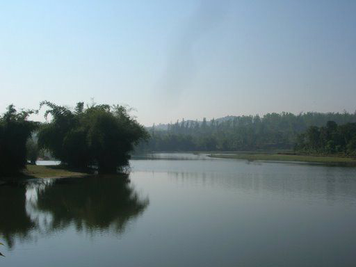
Honnemaradu:- Honnemaradu is an island on the reservoir formed by the Linganamakki dam. It is located in the Sagara taluk of Shimoga district. This place is good for watersports and hence attracts its enthusiasts. Some of the water sports possible here are canoeing, kayaking and wind surfing. Bird-watching enthusiasts also visit this place |
Nearest Petrol Pump: |
| The nearest petrol pumps are available in Sagara and Shivamogga, with others located en route to Jog Falls. i |
Hotels/Lodge/Accommodation: |
| KSTDC Hotel Mayura Gerusoppa: A well-maintained hotel near Jog Falls with basic amenities. Sharavathi Adventure Camp: Offers eco-friendly accommodation and a nature-centric experience. Homestays in Sagara and Shivamogga: Various options available, providing a comfortable stay with local hospitality. |
Things to carry: |
| Comfortable walking shoes for trekking Light, breathable clothing, and rain gear during monsoon Camera for scenic photography Water bottle and snacks Binoculars for birdwatching |
Tips & Suggestions: |
| Wear sturdy footwear and carry rain gear if visiting during the monsoon season.
Keep cash handy as ATMs are limited in remote areas.
Respect wildlife and avoid littering in forested areas.
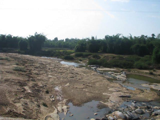
Check water levels before visiting Jog Falls, as its flow varies by season.
km2. The gross capacity of the reservoir is 129.60 cu meters.
Gerusoppa dam:- The Gerusoppa dam project was completed in the year 2002 with the main purpose of generation of electricity. It was constructed near the Gerusoppa village in the Uttara Kannada district. It has a height of 56 metres and a length of 545 metres. |
Help Line/Phone Number: |
| Police Station:Thirthahalli |
| Nearest Hospital:Thirthahalli |
Sharavathi River Nearest Attraction |
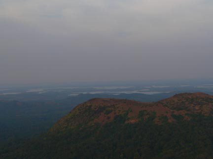
| Agumbe Hillstation |
| Agumbe, a small village located in Karnataka for all those who wish to find peace with nature in the western ghats. It is known to be the wettest region in Karnataka receiving highest rainfall. The tiny village is much known for its beautiful sunset and the trek opportunities it offer.....more |
| Sharavathi Valley Wildlife Sanctuary |
| Located in Shimoga District, Sharavathi Valley Wildlife Sanctuary spans over 431 sq km. Apart from the area occupied by the Liganamakki Reservoir or Honnemaradu, the sanctuary is divided into core zone, buffer zone and tourism zone.....more |
| Shettihalli Wildlife Sanctuary |
| Shettihalli Wildlife Sanctuary is located in Shimoga District of Karnataka. It spreads over 395 sq km of tropical evergreen and semi-evergreen forests. The sanctuary is inhabited by tiger, leopard, wild dog, jackal, gaur, elephant, sloth bear, sambar deer, spotted deer, wild pig,....more |
| Ikkeri Archeology |
| Ikkeri is situated in Shimoga district of Karnataka state at about 3 km to the south of Sagar. The word Ikkeri in Kannada means "Two Streets". This place was the capital of Keladi Nayakas for some years....more |
| Keladi |
| Keladi is 10 km away from Ikkeri and was the Nayaka capital. You enter the precincts with its several small shrines through a long-roofed wooden entrance.....more |
| Barkana Falls |
| Barkana Falls are among the ten highest waterfalls in India. They are located near Agumbe in Shimoga district of state of Karnataka. Barkana falls are formed by Sita river. Currently Barkana falls are the prime source of one of the hydro electric projects in Karnataka.....more |
| Honnemaradu Falls |
| Honnemaradu, the village, having been engulfed in the mid-1960s by the Liganamakki dam, has been literally resurrected today. This haven for water sport enthusiasts, tucked away in the lush greenery of the Western Ghats, is in the Shimoga District in north-west Karnataka, about 25 km from Sagar town on the way to Jog Falls.....more |
| Jog WaterFalls |
| The tallest and no doubt the most impressive waterfall in India, the Jog Falls(also known as the Gerusoppa waterfalls) is located about 400 kms from Bangalore in Karnataka. It is created by the Sharavathi River which comes down in cascades from a height of 292 meters at Gerusoppa in four distinct falls, called the Raja, Rani, Rover and Rocket.....more |
| Kunchikal Falls |
| Kunchikal Falls are the highest waterfalls in India and second highest waterfalls in Asia. They are located near Agumbe in Shimoga district of state of Karnataka. Kumchikal falls are formed by Varahi river. Currently Kunchikal falls are the prime source of one of the hydro electric projects in Karnataka.....more |
| Dandavathi River |
| Dandavathi is a river that flows in Sorab, India. It originates near Kuppe (Sorab taluk) and ends in the Varada river near Sagar. Sorab's Sri Ranganatha temple is built on the bay of the Dandavathi river.....more |
| Varada river |
| Varada River, the only source of water for the Sagar town, is the major river of Shimoga District. Sagar is an industrial town in the heart of the Western Ghats, Sagar is located in Shimoga District of Karnataka. It is 75 km north-west of Shimoga.....more |
| Varahi River |
| Varahi River is a river flowing through Western Ghats to Basrur, Kundapur and Gungulli in western India. Varahi is a west flowing river which takes its birth in the Western Ghats at Hebbagilu, near Agumbe in Shimoga District.....more |
| Gudavi Bird Sanctuary |
| Sorab taluk of Shimoga district, comes alive in June as the energetic chirping of birds fills the air. The tree-lined banks of the Gudavi Lake become a brilliant mosaic of colours, with branches buried under bright plumage.....more |
| Mandagadde Bird Sanctuary |
| The Mandagadde Bird Sanctuary is situated in the Malenaadu region under the Shimoga district, towards Theerthahalli in Karnataka. The Mandagadde Bird Sanctuary has a spectacular collection of migratory birds.....more |
| Gajanur Dam |
| Gajanur is a village 12 km from Shivamogga in the Shivamogga District of Karnataka, India. The Tunga River flows through the village. Gajanur is well known for the dam built across the river.....more |
| Linganamakki dam |
| The Linganamakki dam was constructed by the Karnataka State Government in 1964. Located in the Sagara taluk, the dam has a length of 2.4 km, stretching across the Sharavathi river. It is located about 6 km from Jog Falls....more |
| Tunga Anicut Dam |
| Situiated 15 km from Shimoga, this dam was built across the river Tungabadra. You can enjoy boat trips around the lake. Situated around 15 Km from Shimoga, Tunga Anicut Dam is a popular choice for picnic among the locales.....more |
| Nagar |
| ....more |
| Humbucha |
| ....more |
SELECT YOUR HOLIDAY DESTINATION
-
Aero Sports in Karnataka
-
Archaeology in Karnataka
-
Beaches in Karnataka
-
Bird Sanctuaries in Karnataka
-
Bouldering Spot in Karnataka
-
Camping in Karnataka
-
Cave Explorations in Karnataka
-
Culturals Place in Karnataka
-
Dams in Karnataka
-
Districts Of Karnataka
-
Fairs in Karnataka
-
Festivals in Karnataka
-
Go-Karting in Karnataka
-
Hill Stations in Karnataka
-
Historical Places in Karnataka
-
Holiday Resorts in Karnataka
-
Islands in Karnataka
-
Landscape in Karnataka
-
Mountain Biking in Karnataka
-
National Parks in Karnataka
-
Orbit Network
-
Pilgrims Destinations
-
Para-sailing in Karnataka
-
River rafting in Karnataka
-
Rivers in Karnataka
-
Rock Climbing in Karnataka
-
Safari in Karnataka
-
Temples in Karnataka
-
Trekking in Karnataka
-
Water Sports in Karnataka
-
Waterfalls in Karnataka
-
Wildlife Sanctuaries in Karnataka