Chakra River
Chakra River |
About: |
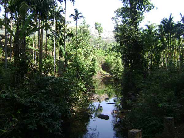
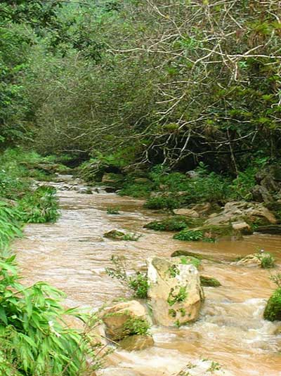
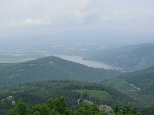
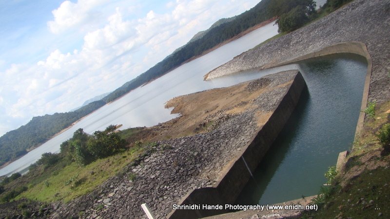
The Chakra River is a beautiful, serene river in the state of Karnataka, India, known for its crystal-clear waters and lush green surroundings. It flows primarily through the Western Ghats, carving its way through dense forests, creating a picturesque landscape that attracts nature lovers, trekkers, and adventurers alike. The river is one of the major tributaries of the Sharavathi River and plays a crucial role in the ecology of the region. Rich in biodiversity, the Chakra River provides an essential habitat for many species of plants and animals, making it an ideal destination for ecotourism. The Chakra nagar is a small town which is famous because of this river.[citation needed] and also there is chakra dam which is built a long ago as power project but it is not running now and you need a special permission to visit this dam.[citation needed] this chakranagar is on the way to Shimoga to Mangalore via Hosanagara Nagara Mastikatthe chakranagar Kundapuar. This name can be traced to the Kundeshvara temple built by Kundavarma in the vicinity of the Panchagangavalli river. Kundapur is also described as the 'town of the sun'. The name may be derived from Kunda, meaning jasmine, owing to the abundance of jasmine-trees in the area. According to others, Kunda means 'pillar', and here refers to the traditional method of constructing houses. Kunda has another meaning, indicating a high place. Up to 18th century, nearby Basrur was important town and Kundapura (a place in high place) was built later, particularly during British period. Kundapur town is surrounded by water from three sides (North - Panchagangavali river, East - Kalaghar water, river, West - Kodi back waters, and further west, Arabian sea), leaving south side as main connecting land mass. |
Location info: |
| The Chakra River flows through the Western Ghats in Karnataka, near towns like Kollur and Hosanagara. It ultimately merges with the Sharavathi River, a primary river in the region. . |
| Best time to visit: Best time to visit Shimoga is between October and March during which the rivers and falls are running full of water after the monsoons. |
Climate/Weather: |
| The region experiences a tropical monsoon climate. The best time to visit the Chakra River is between November and March, when the weather is cool and the humidity is lower. Monsoon season, from June to September, sees heavy rainfall, causing water levels to rise significantly, while summers can be hot and humid. . |
History: |
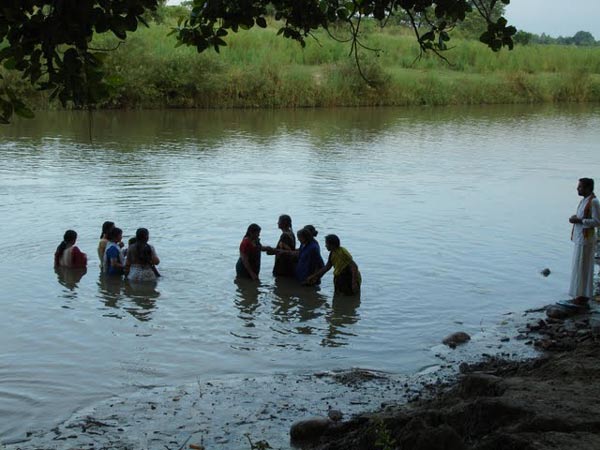
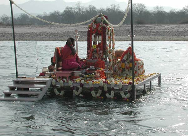
| The Chakra River is closely connected to the history and culture of the Western Ghats region. Ancient civilizations have inhabited the surrounding forests for centuries, drawing water from the Chakra and nearby rivers. The Chakra River is also culturally significant due to its proximity to the Kollur Mookambika Temple, one of the region's most revered Hindu temples, where devotees consider the river to be a sacred body. Furthermore, the Chakra River is significant for the local ecology, and its name is derived from the Sanskrit word "Chakra," symbolizing a wheel or cycle, which is fitting for the ever-flowing nature of this life-giving river. The river is also crucial in supporting the Chakra Dam, which was constructed as part of a larger project to improve irrigation, agriculture, and hydropower in the region. |
Interesting things to do: |
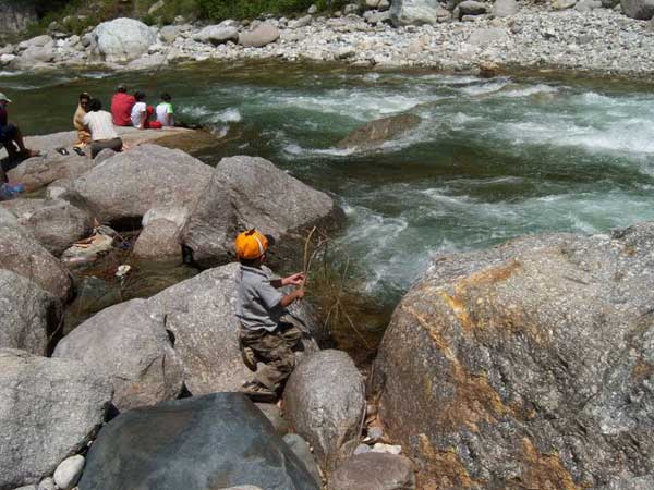
| River Trekking: Explore the Chakra River’s banks by trekking through the forested area. Swimming and Kayaking: Enjoy the cool, clear waters for a refreshing swim or kayak in certain safe areas. Nature Photography: Capture the untouched beauty of the river, with rich biodiversity and lush landscapes. Fishing: Try fishing in designated areas along the river, where it’s permitted. |
Interesting things to Visit: |
| Kundeswara temple is within the town, with big arches. Kundapura town is surrounded on three sides by water / back water - and as such one can find good scenes of water and coconut trees all around. The boat point to Gangolli is one such beautiful place, with vast area of back waters of Haladi river, which joins Arabian Sea nearby. From this point, the range of Western Ghats at a distance of 20 km, including highest peak Kodachadri is a beautiful sight. The three-sides- water- town concept of Kundapur is not exploited to develop tourism industry in this area. There are good number of lodges in this town and well connected by Highway to Mumbai, it has good potential to develop as a scenic place. |
Mobile range info: |
| Mobile connectivity along the Chakra River is generally weak, especially as you move deeper into the forested areas near the river. It's best to carry a portable charger and inform someone about your plans if venturing far from populated areas. |
How to reach? |
| Nearest Railway Station: The nearest railway station is in Kundapura, which is about 60 km from the river.. |
| Nearest Airport: The nearest airport is in Mangalore, around 180 km away.. |
| Road Transport:Kundapur is well connected by Road to Parts of the country. There are buses to Kundapura from Udupi - the bus service is very hot and moving. One can also see Saligrama, Brahmavara while going to Kundapura from Udupi. |
Nearest Visiting places: |
| Kodachadri Hill: A popular trekking destination, located approximately 40 km
from the river.
Agumbe: Known as the "Cherrapunji of the South," Agumbe offers scenic views and
is about 70 km away.
Jog Falls: One of India’s tallest waterfalls, located about 100 km from Chakra
River.
☀ Mekekattu Nadhikeshwara temple is interesting place, about 20 k.m.from Kundapura. It is nearer to Barkuru chowlikere temple. It is considered as the creation of sage Parashurama. With the passage of time the area where the temple is situated has been called by different names. According to the legends, when drought hit this area sage Agastya came here to perform Yajna to please the rain god. During the Yajna, the Asura Kumbha started bothering the sages. To rescue the sages Bhima killed the demon with the help of the sword gifted by lord Ganesha. It attracts several thousand visitors every year. Striking feature of Mekkekattu temple is a collection of coloured, wooden idols which measure up to 10 feet height! Most of the wooden statues are in warrior dress, giving an impression that this entire row of wooden statues are made to remember an incidence of war that would have taken place here during 1600-1700 AD (no historic evidence for this war is found yet, but can be linked to Mogul / Bahamani Invasion). Some of the statues are like Muslim soldires, some like maratha soldies. Some even hold a replica of old gun, some carry swords and ready for war. All wooden statues are given local mytholigical name and there are tiger, crow, moneky also in the row. Yettinahatti, very near to Mekke kattu is interesting place where bulls are worshiped, and may have some historical links with Mekke Kattu. |
Nearest Petrol Pump: |
| The closest petrol pump is in Kollur, around 20 km from the Chakra River area. |
Hotels/Lodge/Accommodation: |
| Accommodation options are available in nearby Kollur and Hosanagara, ranging from budget guesthouses to moderate hotels. Kollur has options close to the Mookambika Temple, popular among visitors to the area. |
Things to carry: |
| Water Bottles and Snacks: The area is remote, so carry your own refreshments. Protective Gear: Wear sunscreen, a hat, and comfortable trekking shoes. Insect Repellent: The river region is prone to insects, especially near the forest. Portable Charger: Mobile connectivity may be spotty, so ensure your phone has sufficient battery. |
Tips & Suggestions: |
| Avoid visiting during the monsoon season, as the river’s water levels can rise quickly. Respect the local ecosystem by not littering and keeping noise levels down. Be mindful of slippery rocks and take precautions if swimming, as certain sections may have strong currents. |
Help Line/Phone Number: |
| police station in Kollur100 |
| Nearest Hospital:Udupi |
Chakra River Nearest Attraction |
| Nethrani Island |
| Nethrani is a small uninhabited island, 18 km southwest off a small fishing village Murdeshwar and is shaped like a upturned boat with some vegetation along the rocky outcrop. The Island is famous for its Shiva temple and for having some of the best dive sites in world....more |
| Kumaradhara River |
| The Kumaradhara River is an Indian river, in the southwestern India state of Karnataka. One of the two major rivers of Sullia, it merges with the Netravati River at Uppinangadi before flowing to the Arabian Sea.....more |
| Shambavi River |
| Shambavi is name of the river which flows in Dakshina Kannada district of Karnataka state, India. Mulki town is south of river Shambavi. The river flows westwards to join the Arabian sea. Bappanadu Durga temple is situated near the river.....more |
| Mukka Beach |
| Mukka is suburb of Mangalore city on the shore of Arabian sea. It is located to north of NITK,Surathkal campus on National Highway 17. There is a beach in Mukka which has escaped public attention....more |
| Panambur Beach |
|
Panambur is the site of New Mangalore Port. It is located in Dakshina Kannada (formerly South Canara ) district of Karnataka state, India, north of the Gurupura river.There is a Nandaneshwara temple in Panambur.....more |
| Someshwar Beach |
| Someshwar Beach, blessed with an endless stretch of golden sand and graciously swaying palm trees, is located 9 km south of Mangalore. The beach is well known for a large rock called 'rudra shila'.....more |
| Surathkal Beach |
| Located 15 km north of Mangalore, Suratkal Beach is known for its clean surroundings and a lighthouse. An uninterrupted and extremely attractive stretch of curving shoreline is a major feature of this beach. Sadashiva Temple is a nearby attraction.....more |
| Tannirubhavi Beach |
| Tannirubhavi beach is a beach in Mangalore, Karnataka, India. Currently, it can only be reach by land via Panambur or by ferry via Gurupura river from Sultan Battery.....more |
| Ullal Beach |
| Ullal Beach is situated about 12 km away from Mangalore on the south bank of the Nethravati River, facing Arabian Sea. Mangalore is a city of vivid contrasts. Apart from this beach, there are other beaches also in Mangalore.....more |
| Dharmasthala Temples |
| Dharmastala kshetra is located amongst the scenic beauty of the Western Karnataka on the banks of the Nethravathi River. The temple of Lord Manjunatha at Dharmastala is the star attraction in the Karnataka. ....more |
| Kadiri Temples |
| The 17th century Manjunath Temple is situated at the foot of the Kadiri Hill, 3 km north of Mangalore city. The temple has some superb bronze images of Buddha, dating to the 10th - 11th centuries. The idol of Lord Manjunathaswamy of the temple is believed to be the oldest of the South Indian Temples.....more |
| Katil Temples |
| The Name KATEEL: The
word 'Kati' which means 'center' (between the 'Kanakagiri', birthplace of river
Nandini and the end) and 'lla' which means 'area'. Thus the place is called
'Kati + lla' = Kateel. Kateel or Kateelu is a temple town in the Dakshina Kannada district of Karnataka, India. It is about 29 kilometers away from Mangalore and is considered one of the holiest temple towns in Hinduism.....more |
| Subramanya Temples |
| Kukke Subrahmanya Kshetra lies in the luxurious abundance of the beauty of the nature nature with rivers, forests and mountains in Sullia Taluk of Dakshina Kannada (South Canara) District. Kukke Subrahmanya Temple is regarded as one of the seven Mukti stala pilgrimage sites of Karnataka. (Kollur, Udupi, Kumbasi, Kodeshwara, Sankaranarayana and Gokarna are other Mukti places)....more |
| Mangalore Archeology |
| This temple is at the foot of the Katri hills, north of Mangalore. It is full of pilgrims. The temple belongs to the 10th century, but the pyramid like tower belongs to another time....more |
| Mangalore Historicals |
| Situated in the Western Ghats of Karnataka, Mangalore is one of the important centers of exporting coffee and cashew nut. It is a hilly city with winding disoriented streets located some 357 km away from the city Bangalore....more |
| Mudabidri |
| Mudabidri is another Jain town on par with Shrvanabelagola. It is 35 km from Mangalore. In this small farming town, there are 18 jain temples.....more |
| Alekan Waterfalls |
| Alekan is one of the attractive waterfalls in Dakshina Kannada District of Karnataka. It is noted for its picturesque locale. Bale Kallu Gudda - one of the highest hills in Dakshina Kannada District - is nearby. A winding scenic journey from Charmadi, 18 km away, takes to Alekan Waterfalls. Alekan Waterfalls is roughly four kilometers from kottigehara.....more |
| Bandaaje/Bandaje Arbi falls |
| Bandaaje Arbi Falls, one of the beautiful waterfalls in the Western Ghats, is located near Mundaaje, in Dakshina Kannada District of Karnataka. It cascades down from a height of 200 ft.....more |
| Dondole Falls |
| Dondole waterfalls is a nice water falls which is around 20 kms from a place called Kakkinje which is just 3kms before charmadi from Ujire. Part of this 20 kms can be covered in a jeep and after a rivercrossing and 50minutes of walk through the forest one reaches this waterfall which is of around 50+ft height.....more |
SELECT YOUR HOLIDAY DESTINATION
-
Aero Sports in Karnataka
-
Archaeology in Karnataka
-
Beaches in Karnataka
-
Bird Sanctuaries in Karnataka
-
Bouldering Spot in Karnataka
-
Camping in Karnataka
-
Cave Explorations in Karnataka
-
Culturals Place in Karnataka
-
Dams in Karnataka
-
Districts Of Karnataka
-
Fairs in Karnataka
-
Festivals in Karnataka
-
Go-Karting in Karnataka
-
Hill Stations in Karnataka
-
Historical Places in Karnataka
-
Holiday Resorts in Karnataka
-
Islands in Karnataka
-
Landscape in Karnataka
-
Mountain Biking in Karnataka
-
National Parks in Karnataka
-
Orbit Network
-
Pilgrims Destinations
-
Para-sailing in Karnataka
-
River rafting in Karnataka
-
Rivers in Karnataka
-
Rock Climbing in Karnataka
-
Safari in Karnataka
-
Temples in Karnataka
-
Trekking in Karnataka
-
Water Sports in Karnataka
-
Waterfalls in Karnataka
-
Wildlife Sanctuaries in Karnataka