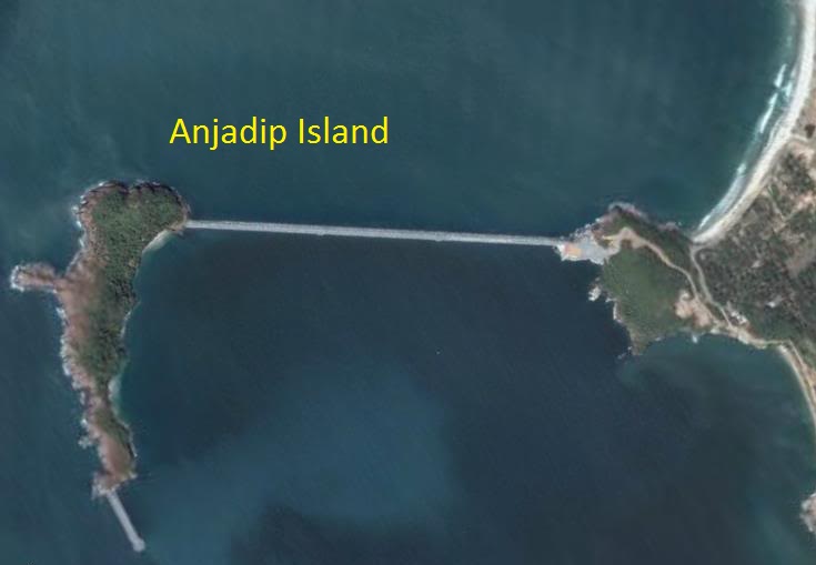
Anjadiv Island
Anjadiv / Anjadip / Angediva Islands |
About: |
.jpg "DevOps Training With AWS")
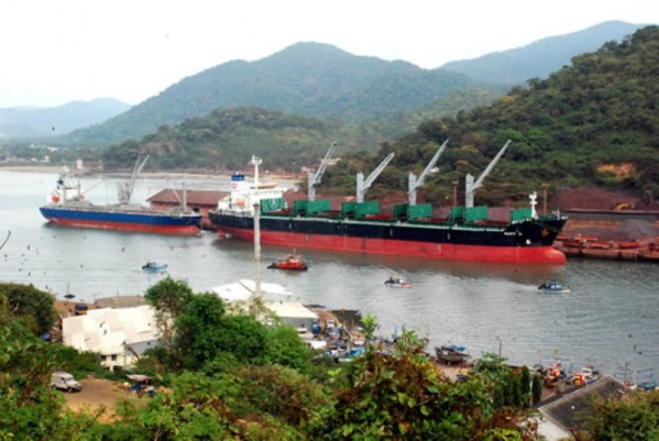
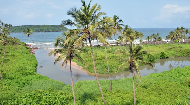
Anjadiv Island, also known as Anjadiva Island, is a small but historically significant island located off the coast of Karnataka and Goa. Known for its rich Portuguese colonial history, ancient churches, and fort ruins, Anjadiv Island holds a special place in local folklore and Indian history. The island covers an area of about 1.5 square kilometers and has been an important stopover for traders, explorers, and even pirates due to its strategic location. It is presently under the administration of the Indian Navy and forms part of the INS Kadamba Naval Base. |
Location info: |
| Anjadiv Island is situated in the Arabian Sea, off the coast of Karwar in Karnataka. It is approximately 5 nautical miles from the Karwar coast and is geographically closer to the state of Goa. The island is part of the Karwar district of Karnataka but is accessible mainly from the southern coast of Goa. |
Climate/Weather of Anjadiv Island: |
| Summer (March-May): Warm and humid with temperatures ranging from 25°C to 35°C. Monsoon (June-September): Experiences heavy rainfall due to the southwest monsoon, with temperatures ranging between 23°C to 28°C. The island becomes lush and green during this season but may not be accessible due to rough seas. Winter (October-February): Cool and pleasant with temperatures between 20°C and 28°C, making it the ideal time to visit. |
History of Anjadiv Island: |
|
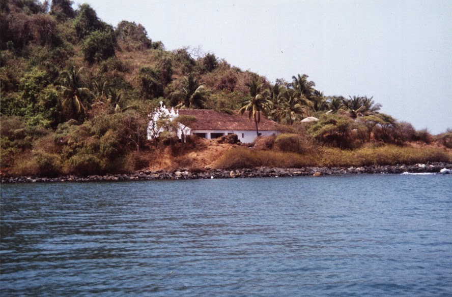
Anjadiv Island has a history dating back to the 1500s when it served as a Portuguese colony. The island was used as a strategic military and trading point by the Portuguese, and they built a fort and churches here, including the St. Francis of Assisi Church and Our Lady of Springs Church. The island was an important naval base for the Portuguese in their battles with the local rulers of Goa and Karnataka. Today, remnants of Portuguese architecture and colonial ruins are still visible. The island was handed over to the Indian Navy after independence, and it currently forms part of the INS Kadamba Naval Base, restricting public access. The Portuguese colonized the island and built a fort and a church (Church of Lady Brothers). The Maplis of Kerala settled on the island in due course, and called it "Anaja Diva". The Portuguese corrupted it to Anjidiv. After India became free (after an epic struggle against the British) in 1947, the island continued under Portuguese rule, and to symbolize their authority, the Portuguese Government set up a liquor shop on the island (a move certainly in mockery of Gandhi's prohibition ideology) and appointed four people to operate it. The bar did extremely well, selling over Rs.75,000 worth of feni (a popular variety of local liquor) a fortnight, most of it finding its way to India. This practice continued till 1961. |
Interesting things to do: |
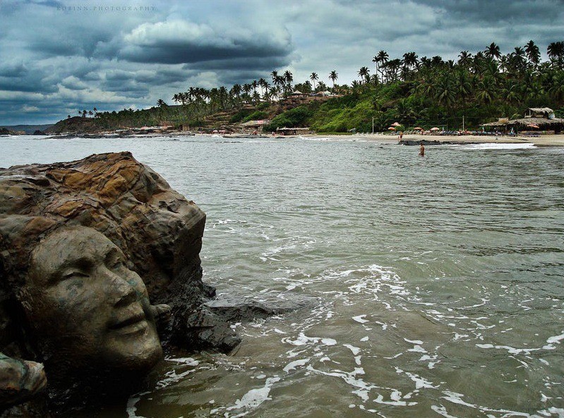
| Historical Exploration: Tour the ruins of Portuguese architecture, including old churches, fort remnants, and colonial structures that showcase Portuguese influences. Photography: The island’s colonial ruins, combined with scenic coastal views, make it an ideal spot for photography. Bird Watching: The island, with its unique flora, attracts various bird species, making it an interesting spot for bird watchers. Beach Walks and Scenic Views: Take a walk along the island’s small beaches and coastal areas to enjoy breathtaking sea views.; |
Interesting things to Visit: |
| St. Francis of Assisi Church: A historical church on the island, believed to have been built by the Portuguese, showcasing classic Portuguese architecture and style. Our Lady of Springs Church: Another church dating back to the Portuguese era, known for its historical significance and scenic location. Fort Remnants: Explore the ruins of an old Portuguese fort that once served as a stronghold against local rulers and invaders. Naval Installations: While the island is restricted due to the presence of the Indian Navy, glimpses of the naval installations are visible, highlighting the island’s strategic importance. |
Mobile range info: |
| Mobile network coverage on Anjadiv Island is limited, especially since the island is under naval administration. Signal reception is weak, and some providers may have no coverage at all. |
How to reach Anjadiv Island? |
| Nearest Railway Station:Nearest station at Shirwad, 6kms from Karwar Town, Konkan Railway route. |
| Nearest Airport: The nearest airport is Goa’s Dabolim Airport, about 50 km away from Karwar. From Dabolim, visitors can travel to Karwar by road. |
|
Road Transport:Reach Karwar (nearest coastal town in Karnataka) by road, and then take a ferry or boat from Karwar port. Entry to the island is controlled, so prior permission from authorities is required. Anjidiv Island can be approached from Goa via Karwar by land or rail. From
the Officers (Sea Bird) Gate, a two km causeway takes one to this historical
site. |
Nearest Visiting places in Anjadiv Island: |
|
Mapusa: This is situated at 13kms from the district headquarters. This place is the capital of Bardez Taluka, which is on the NH 17. It is at the cross roads of the network of highways covering whole of North Goa. There is weekly fair, which is celebrated on Friday and is held at the modern streamline market. A large crowd usually comes to attend the market and enjoy a lot at that place. There are many beautiful places in Karwar. Some of them are: The district of north Goa is full of tourist places as it has beaches, temples, churches, museums, art galleries, gardens, peaks and many more which are an essential feature to become a perfect tourist spot.Some of the important places, which are regarded as the tourists` spots can be mentioned as follows: Panaji: this is the capital of Goa and also the headquarters of North Goa District. This is basically a small and charming city on the left bank of silvery Mandovi River. The beautiful red-roofed houses are seen in abundance in the city. These houses are built in Latin style. This district can also boasts of many modern houses, well laid gardens, statues and avenues lined with Gulmohar, Acassia and other trees. The enthralling scenic beauty can be found when it is viewed from atop Altinho or from the hilltop. Pilar: This is placed at the distance of 11 Km from district headquarters. This is an important religious and educational centre of Christian Missionaries as well. The Church, Seminary and School atop hillock command a magnificent panorama of the countryside around. This place is also has a fine view of Mormugao Harbour & Zuari River. People always like to visit the place. |
Nearest Petrol Pump: |
| The nearest petrol pump is available in Karwar, approximately 14 km from Anjadiv Island. |
Hotels/Lodge/Accommodation nearby Anjadiv Island: |
| As the island has no accommodation facilities, it’s best to stay in Karwar, where you’ll find various hotels, guesthouses, and lodges. |
Things to carry: |
| Valid ID and Permission Documents (entry is restricted). Water and Snacks: Facilities on the island are limited. Sunscreen, Hat, Sunglasses: To protect from sun exposure. Camera: To capture the scenic landscapes and historical sites. First Aid Kit: For minor injuries. |
Tips & Suggestions for Anjadiv Island: |
| Obtain Permission: The island is under the Indian Navy’s jurisdiction, so ensure you have the necessary permits. Weather Check: Avoid monsoon season due to rough seas and limited access. Respect Local Regulations: Follow all rules set by authorities for safety and preservation of the island. |
Help Line/Phone Number: |
| For permission and information, contact Karwar Tourism Office or Naval Base, Karwar for specific guidelines. |
Anjadiv Islands Nearest Attraction |
| Anjadiv / Anjadip / Angediva Islands |
| The Anjadiv (a.k.a Anjidiv) Islands, about a mile away from the village of Binaga in Karnataka, but belonging to the state of Goa, have been famous in Indian culture since the puranic period. A renaissance poet has described it as the "resting place of Venus and her beloved".....more |
SELECT YOUR HOLIDAY DESTINATION
-
Aero Sports in Karnataka
-
Archaeology in Karnataka
-
Beaches in Karnataka
-
Bird Sanctuaries in Karnataka
-
Bouldering Spot in Karnataka
-
Camping in Karnataka
-
Cave Explorations in Karnataka
-
Culturals Place in Karnataka
-
Dams in Karnataka
-
Districts Of Karnataka
-
Fairs in Karnataka
-
Festivals in Karnataka
-
Go-Karting in Karnataka
-
Hill Stations in Karnataka
-
Historical Places in Karnataka
-
Holiday Resorts in Karnataka
-
Islands in Karnataka
-
Landscape in Karnataka
-
Mountain Biking in Karnataka
-
National Parks in Karnataka
-
Orbit Network
-
Pilgrims Destinations
-
Para-sailing in Karnataka
-
River rafting in Karnataka
-
Rivers in Karnataka
-
Rock Climbing in Karnataka
-
Safari in Karnataka
-
Temples in Karnataka
-
Trekking in Karnataka
-
Water Sports in Karnataka
-
Waterfalls in Karnataka
-
Wildlife Sanctuaries in Karnataka