Home » Rivers In Karnataka  »  Shimsha River

Shimsha River

Shimsha River

About:

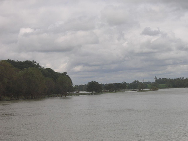
Shimsha is a river that flows in the state of Karnataka, India. It is one of the tributaries of the river Kaveri, which is one of the major rivers of South India. The river originates in the southern part of the Devarayanadurga hill in the Tumkur district of Karnataka and flows for about 221 km. before joining the river Kaveri.

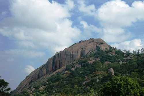
Origin:-Shimsha originates at an altitude of 914 mts. in the Devarayanadurga hill which is also the location of two temples of the Hindu God, Narasimha.
Shimsha River is one of the tributaries of the river Cauvery, originating from the Tumkur District of Karnataka. This river has a catchment area of about 8,469 sq km. The sub tributaries of Shimsha River are Veeravaishnavi, Kanihalla, Chickkhole, Hebbahalla, Mullahalla and Kanva. The Shimsha River merges with the Cauvery at Shimsa. The river has a total length of 221 km. A beautiful sprawling dam is built across the Shimsha River in Igglur.

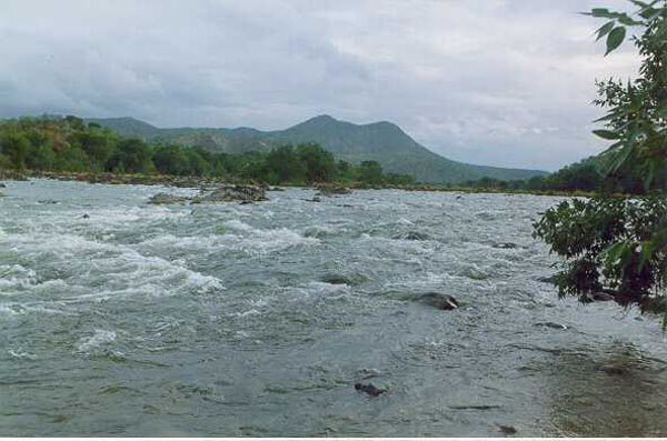
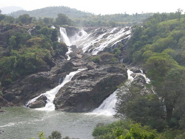
Course:-After originating in the Tumkur district, the river takes a southerly course and enters the Mandya district. In Mandya district, the river flows in a south-eastern direction and has a waterfall at Shimshapura in Malavalli Taluk. Just after Shimshapura it reaches the border of Chamarajanagar district where it joins the river Kaveri.[2] The confluence of Shimsha and Kaveri is also near the Shivanasamudra falls. The total length of the river is 221 km. and the river has a catchment area of 8469 km2

Sub-tributaries:-In its course the river is joined by other smaller rivers and streams such as Veeravaishnavi, Kanihalla, Chikkahole, Hebbahalla, Mullahalla and Kanva.

Dams:-
Markonahalli Dam: Markonahalli Dam is a dam built across the river Shimsha in the Kunigal Taluk of Tumkur district. It was built by Krishnaraja Wodeyar IV, the king of Mysore under the guidance of his Diwan, Sir M Visweswaraiah.[3] It was built to irrigate 6070 hectares of land and has a masonry structure of 139 m and a pair of earth dams extending to 1470 metres on either side. The reservoir has a catchment area of 4103 km2 and can hold a volume of 68 million m3 of water at a full reservoir level of 731.57 m above the mean sea level.[4] 27 species of fish, including 13 species of commercial fishes have been recorded in the reservoir with Puntius being the dominant species of fish found here. Cirrhinus reba and Labeo calbasu and other transplanted carps are also found here. However, the maintenance of the dam has been poor. In the year 2000, a part of the dam had to be demolished to prevent floods and save 25 villages.[3] Water started overflowing the dam and only 1 crest gate could be opened. Nearly 150 feet of the dam was demolished in order to allow excess water to flow out.[3]

Power generation: Shimsha has its waterfall at Shimshapura in Malavalli Taluk. This is also the location of the Shimsha Hydro Electric Project which has an installed capacity of 17,200 kilowatts. It was the first ever hydro electric project in Asia. Kolar Gold Fields was supplied with the electricity generated in the year 1902. Three years later Bangalore was electrified. (Prjavani daily 16th Oct 08) The foundation stone for this project was laid by Krishnaraja Wodeyar IV, the king of Mysore in December 1937.

Location info:

Address:The river originates in the southern part of the Devarayanadurga hill in the Tumkur district of Karnataka
District:Tumkur district
Nearest City:Maddur
Best time to visit:

Climate/Weather:


History:

The place was originally known as Anebiddasari then as Jadakana Durga after a chief named Jadaka and finally as Devarayana Durga subsequent to its capture by Mysore king Chikka Devaraja Wodeyar.

Tradition relates that a robber chief named Andhaka or Lingaka had his stronghold here, and he was subdued by sumati, a prince, whose father, Hemachandra, was the king of Karnata and ruled from Yadupattana. On accomplishing the enterprise on which he had set forth, Sumathi is said to have established the city of Bhumandana near the present Nelamangala and taken up residence there for the protection of that part of his fathers kingdom.

Under the Hoysalas, there seems to have been, on the hill, a town called Anebiddasari or the precipice where the elephant fell. A rogue elephant, which the sthala purana describes as a Gandharva suddenly appeared before the town to the great consternation of the people and after doing considerable mischief, tried to walk up the steep rock on the west, when it slipped, fell back and was killed. The hill is accordingly called as Karigiri in the Puranas.

Under the Vijayanagara Kings, the use of the same name continued, and a large tank, named Bukkasamudra, was formed after throwing an embankment across the gorge from which the river Jayamangali has its source. Remains of the embankment and of the adjacent town can still be traced.

Interesting things to do:

Festival:-
CAR FESTIVAL:-Devarayana Durga Sri Bhoga Narasimhaswamy jathra/Car festival, an annual Car festival is held during Phalguna Masa shuddha poornima day some where in the Month of March/April in Devarayanadurga. On this day the chariot/car/Ratha of Sri Bhoga Narasimhaswamy is drawn in the main Ratha beedhi of the hill town. The festival draws devotees from all over Bangalore-Tumkur and surrounding region.

NARASIMHA JAYANTHI:-Devarayanadurga Sri Lakshminarasimhaswamy's Narasimha jayanthi, an annual celebration of Narasimha avathara day takes place during Chaitra Shudha chathurdashi (May month) at which thousands of people gather and many pendals are built to serve then with summer drinks like Panakam, buttermilk, phalamruth and free feeding is done to all devotees coming for the darshan of lord.

Interesting things to Visit:

Lakshmi Narasimha Swamy Temple:- The temple, built in the dravidian style of architecture, faces east and is said to have been constructed by Kanthirava Narasaraja I. From the inscriptions numbered Tumkur 41 and 42, we learn that the enclosure and tower were repaired in 1858 by the Mysore king Krishnaraja Wodeyar III.
The TVS Group, a south Indian automobile company, has helped a great deal in the improvement and maintenance of the temple environs.
BhogaNaraishma temple is at the base of the hill and Yoga Narasimha temple is on top of the hill. Temple of Yoga Narasimha

Other Temples:- On the third elevation stands, facing east, a temple of Narasimha, known as the Kumbhi. This Narasimha temple consists of a Garbhagriha, a sukanasi, a navagraha and a mukhamantapa and is similar to the plan of the temple below. In addition to the temple there are three sacred ponds or Kalyani here known as Narasimha-teertha, Parasara-teertha and Pada-teertha.
There is also another temple, said to be older than Lakshmi Narasimha swamy, dedicated to Hanuman, also known as Sanjivaraya, who stands with folded hands.
Higher up above is a small shrine of Garuda.
Giri-Pradakshina:- Legend has it that the devotees of Hindu temples used to perform the ritual of circling the hills on which the temples were situated. As an effort to revive the practice, a large number of Devotees perform the Giri-pradakshina, organized by Vishwa Hindu Parishad(VHP)

Namada Chilume:- At the base of the hill on the road leading to Tumkur, is a place called NAMADA CHILUME (nAmada chilume; chilume means spring). Myth has it that Sri Rama on his way to Lanka halted here. As he did not find water anywhere around to wet the "nAma" (a kind of paste Hindus apply on their forehead), he shot an arrow into the ground, and a spring sprang and thus the name (Rama)-nAmada chilume. The spring can be still seen, and there is a foot impression of Lord Sri Rama near that.

Little away from the current government guest house, just facing the spring is an old, dilapidated guest house constructed in 1931. Dr. Salim Ali was said to have stayed in this guest house during his Ornithological visits to this place, around 1938. Interestingly enough there is a moist deciduous patch behind the old guest house, adjoining the huge rock face and Dr. Salim Ali had collected moist-deciduous species in this area, which are no longer to be seen now. Old Guest House where Dr.Salim Ali had camped

Nursery:-The forest department has developed a nursery of medicinal plants near Namada Chilume picnic spot on Devarayanadurga hills. There are about 300 varieties of rare ayurvedic plants in this nursery.
Only particular species of plants are cultivated on specified plots for easy identification of the plant varieties. The nursery is located at a forest spot beside Tumkur-Devarayanadurga bus route.
The nursery, known as the mini forest of medicinal plants, has been developed with the objective of conserving endangered species of plants on Devarayanadurga hills.

Mobile range info:


How to reach?

Nearest Railway Station:Banglore
Nearest Airport:Banglore
Road Transport:It is 65 km from Bangalore, India, by road on Tumkur road. The nearest railway station is 25 km away in Dobbespet.There are 2 routes to this place.
1. From Banglore, go till Dobbespet. Go under the flyover and take a right. (note: The left here leads to Shivagange betta and right leads to Devarayandurga.) This road is in quite bad shape and it is a longer approach to Devarayanadurga. On this route you get Devarayanadurga first, and then as you go towards Kyatsandra, you get another Hanuman and Shankara temple, a little further is Namada Chilume and then Siddaganga mutt (different from Siddagange betta) and a kilometer from there is Kyatsandra where you hit Banglore Tumkur road.
2. The other route from banglore is from Kyatsandra. About 1Km after crossing second toll gate on Tumkur road take right at Kyatsandra. After crossing railway level cross you reach Siddaganga Mutt then Namada Chilume then Hanuman Temple and finally Devarayanadurga. The roads on this side are much better and this route is shorter.

Nearest Visiting places:

Tumkur district is an administrative district in the state of Karnataka in India. The district headquarters are located at Tumkur. The district occupies an area of 10,598 km2 and had a population of 2,584,711, of which 19.62% were urban as of 2001. [1] It is a one and a half hour drive from Bangalore, the capital of Karnataka.

The area of the district is 4158 m2. It consists chiefly of elevated land intersected by river valleys. A range of hills rising to nearly 4,000 feet (1,200 m) crosses it from north to south, forming the watershed between the systems of the Krishna and the Kaveri. The principal streams are the Jayamangala and the Shimsha. The mineral wealth of Tumkur is considerable; iron is obtained in large quantities from the hill-sides; and excellent building-stone is quarried. The slopes of the Devarayanadurga hills, a tract of 18 m2., are clothed with forests, in which large game abounds, including tigers, leopards, bears and wild hog. The annual rainfall averages 39 inches.

Nearest Petrol Pump:

Maddur

Hotels/Lodge/Accommodation:

KSTDC operates a hotel in Devarayanadurga called Hotel Mayura Meghadoota.

Things to carry:


Tips & Suggestions:

Issues:-
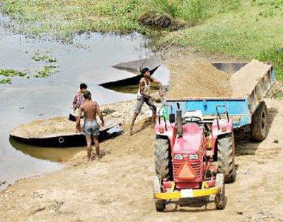
Sand mining:-The sand found on the river bed of the Shimsha river is mined and used for construction activities, sometimes illegally. Due to the environmental issues that can be caused by sand mining, this activity is currently banned.
Sand mining in the area, conservationists fear, will affect the birdlife in the long run as the water turns turbid. Once the water turns turbid, aquatic life, especially the plant life gets affected, which will in turn affect the entire food cycle. Besides, the shoreline of the river also gets damaged permanently, they point out. Kokkare Bellur has been rated by the Birdlife International and Bombay Natural History Society among the 466 sites in the country rich in birdlife.

Pollution:-Discharge of waste from towns and cities on the way are major contributors to pollution in the Shimsha. However, the Government is trying to clean up the river and has released funds for the same.

Help Line/Phone Number:

Police Station:Maddur
Nearest Hospital:Maddur
Society/Community Phone Number

Shimsha River Nearest Attraction

Aralaguppe
There are Hoysala temples here belonging to the last days of the Hoysala dynasty. The Kalleshwara temple of the much older Noramba dynasty is famous here. Noramba dynasty ruled the Karnataka area at the same time as the West Ganga dynasty and built many temples here.....more
Kaggaladu Heronry Sanctuary
A nondescript village in Tumkur district wakes up each year to the raucous cries and colourful plumage of painted storks and grey herons as they nest on old tamarind trees amidst the houses. This is the only place in Karnataka where these species nest side by side.....more
Marconahally Dam
A large minor irrigation project dam built in 1942 by the British.Markonahalli Dam is a dam built across the river Shimsha in the Kunigal Taluk of Tumkur district. It was built by Krishnaraja Wodeyar IV, the king of Mysore under the guidance of his Diwan, Sir M Visweswaraiah.Constructed across river Shimsha.....more