St. Mary's Island
St. Mary's Island |
About: |
|
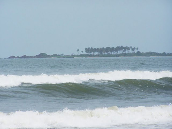
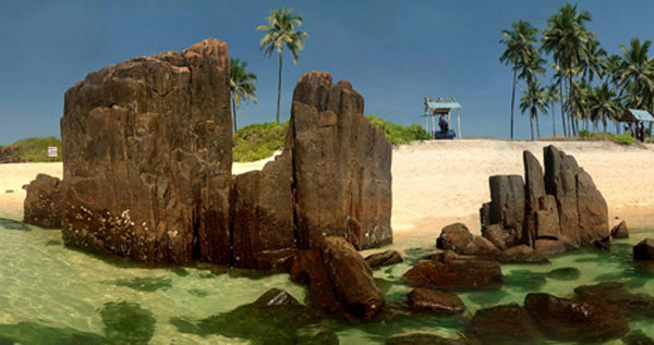
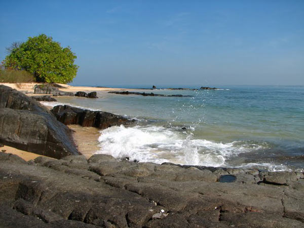
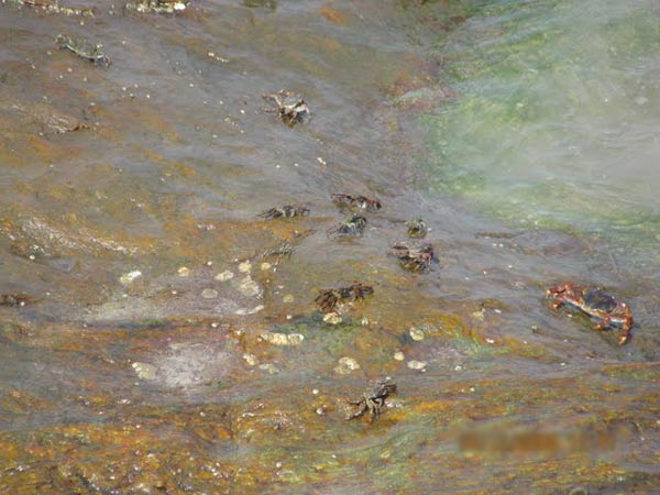
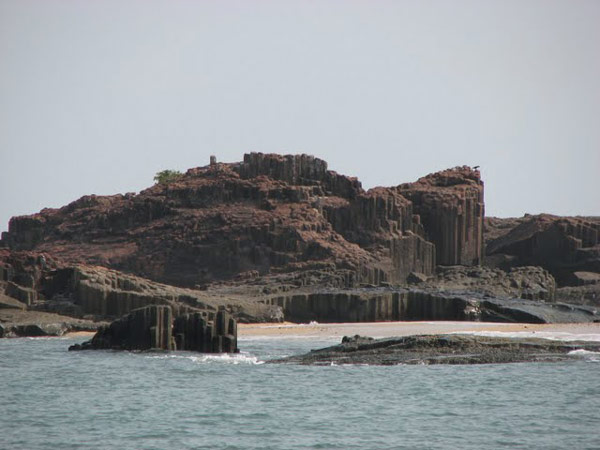
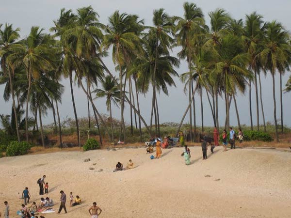
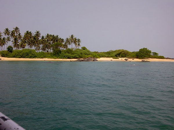
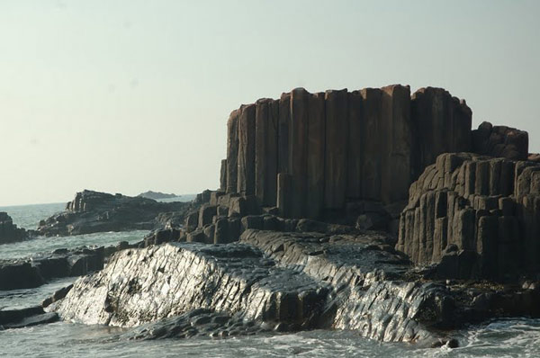
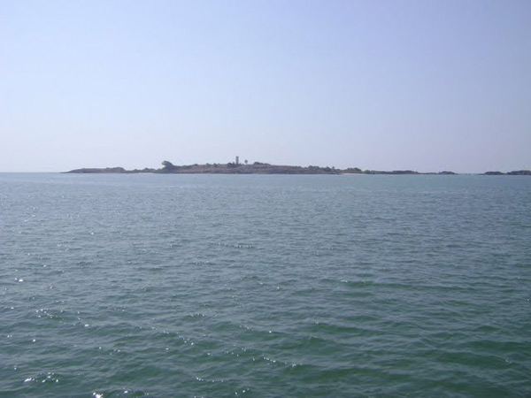
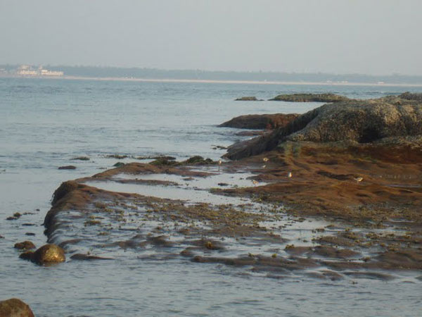
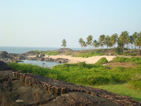
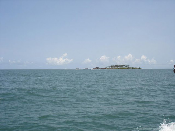
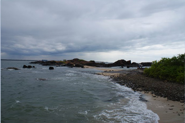
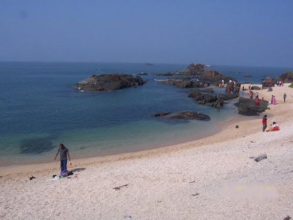
Located 58 km north of Mangalore, the St. Mary's Island beach is special for the unique formation of basalt rocks which have crystallized into columns and split into vertical hexagonal blocks. This group of islands is accessible by ferry from Malpe which is a major fishing harbor. Contrary to other beaches with endless stretch of golden sand, St Mary's Island's rocky terrain does not encourage swimming or strolling along the shores. One can only gaze around and marvel at the idiosyncrasies of the expansive rock formations strewn around the beach. |
Location info: |
| Address:60 Kms from Mangalore, 400km from Bangalore. |
| District:Udupi district |
| Nearest City:Bangalore |
| Best time to visit: December to March |
Climate/Weather of St. Mary's Island: |
| Summers 22°- 40°C. Winter 10°- 32°C |
History of St. Mary's Island: |
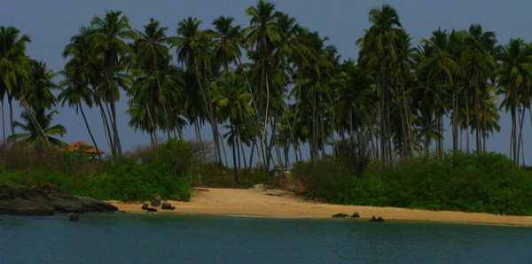
| St Mary's group of islands got their name courtesy Portuguese explorer Vasco da Gama who descended on these islands in 1498 before he reached Calicut. Gama called one of the islands "El Padron de Santa Maria." The northernmost island is about a square mile in area and not more than 250 yards in width. It has a coconut grove, which makes it the shadiest island of the group and gives it true South Sea color.
|
Interesting things to do: |
Interesting things to Visit: |
Mobile range info: |
How to reach St. Mary's Island? |
| Nearest Railway Station:Train Stations Udipi Railway Station |
| Nearest Airport:Nearest Airport Mangalore Airport or Bangalore international airport. |
|
Road Transport: Main Road Highways NH 17 |
Nearest Visiting places: |
| 1.Malpe 2.Kundapur 3.Moodabidri 4.Surathkal 5.Kudremukh 6.Maravanthe 7.Mangalore 8.Shimoga |
Nearest Petrol Pump: |
| Udupi |
Hotels/Lodge/Accommodation nearby St. Mary's Island: |
| Rukmini Residency, Near City Bus Stand, Udupi Dist, Udupi - 576101. Phone: +91-820-2523901, Fax: +91-820-2523918. Email: rr@rukminiresidency.comThis e-mail address is being protected from spam bots, you need JavaScript enabled to view it Shri Ramakrishna Hotel, Geethanjali Road, Udupi - 576 101. Phone : +91 8252 - 523189 |
Things to carry: |
Tips & Suggestions for St. Mary's Island: |
Help Line/Phone Number: |
| Police Station:100 |
| Nearest Hospital:Udupi |
| Society/Community Phone Number |


St. Mary's Island Nearest Attraction |
| Kollur Temples |
| Kollur Mookambika Temple, an important seat of Shakti worship is located in very picturesque surroundings at the foot of the Western Ghats in Kundapur taluk of Udupi district. This sacred place is situated on the banks of river sauparnika and surrounded by thickly wooded hills and has a natural formation resembling the Sri Chakra. Kollur is one of the seven mukti places which were created by Parashurama.....more |
| Udupi Temples |
| Udupi, the Kokani city is the headquarters of the Udupi District, Karnataka State, India. When one hears the name "Udupi" either "Udupi Krishna" or "Udupi Masala Dosa" comes to the mind. Of course the famous, Krishna temple is located in this city. The temple is famous for a unique statue of Lord Krishna.....more |
| Kollur Forest |
| Kollur is a tiny hamlet situated 40km Kundapur Town, about 140 km away from Mangalore City in Karnataka state in Southern part of India. This village lies at the foot of the Western Ghats, and is famous for the Mookambika temple, a Hindu pilgrim center.....more |
| Mookambika Wildlife Sanctuary |
| Located in Udupi District, Karnataka, Mookambika Wildlife Sanctuary spans over 247 sq km and is thick with evergreen, semi-evergreen and moist deciduous forests of the Western Ghats, and small patches of teak plantations. It is contiguous with the Sharavathi Valley Wildlife Sanctuary.....more |
| Someshwara Wildlife Sanctuary |
| Located in the Western Ghats, Someshwara Wildlife Sanctuary in Udupi District of Karnataka. This 88 sq km sanctuary is consists of semi-evergreen and evergreen forests. Wildlife species include tiger, leopard, wild dog, jackal, gaur, wild pig, sambar deer, spotted deer, barking deer, lion tailed macaque, bonnet macaque and common langur.....more |
| Karkala |
| Karkala is a town and also the headquarters of Karkala Taluk in Udupi district of Karnataka, India, and is located about 300 km from Bangalore. It lies near the Western Ghats. The first name of this town was Pandya Nagari during the Jain regime but afterwards it was changed to Karikallu because of black stones.....more |
| Koosalli Falls |
| The fabulous picnic spot, Koosalli waterfalls is located near Koosalli village in Kundapura. A series of six falls, one above the other, in splendid surroundings makes it one of the best waterfalls in the state. The combined height of all six falls is about 380 ft....more |
| Gurupura or Phalguni River |
| Gurupura river flows through Gurupura, Mangalore, Tannirubhavi. It joins the Arabian sea near Tannir bhavi. is the chief port city of the Indian state of Karnataka. Bounded by the Arabian Sea and the Western Ghat mountain ranges, Mangalore is the administrative headquarters of the Dakshina Kannada (formerly South Canara) district in southwestern Karnataka.....more |
| Kedaka River |
| The Kedaka River is a river flowing through Kundapur and Gungulli in western India. It joins with the Souparnika River, Varahi River, Chakra River, and Kubja River and merges into the Arabian Sea.....more |
| Pangala River |
| Pangala is a village situated in Udupi taluk of Udupi district, Karnataka. India's National Highway number 17 (NH-17) road connecting Mangalore (Kudla or Mangaluru) to Mumbai (Bombay) passes through this village.The village is on the north banks of Pangala river.....more |
| Souparnika River |
| Souparnika River is a river flowing through Kundapur and Gangolli in western India. It joins with the Varahi River, Kedaka River, Chakra River, and Kubja River and merges into the Arabian Sea.Sauparnika is a sacred river which emerges from a verdant mountain near Maravanthe in Udupi District of Karnataka.....more |
| Udyavara River |
| Udyavara is a village on the outskirts of the town of Udupi, Karnataka, India. It is located to south of Udupi, and to the north of the Udyavara river. Udyavara was formerly called Udayapura. It was the capital of the Alupas.....more |
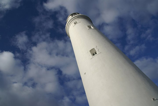
| Kaup Beach |
| Kaup Beach is located 12 km south of Udupi. It is situated on the coastal belt. The Kaup beach is one of the most beautiful beaches. Its placement is perfect. The beach with the 100 ft high lighthouse on the rocks is a photographer's paradise.....more |
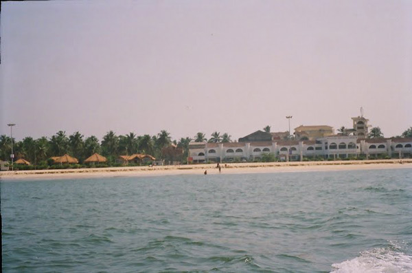
| Malpe Beach |
| About 6 kms from Udupi, in South Canara is Malpe, an ideal picnic spot with its virgin beach. The endless stretch of golden sand, graciously swaying palm trees, the clear blue sky and the gurgle of the sea all set a perfect mood for an unforgettable holiday here....more |
| Trasi Beach |
|
Trasi is a beautiful place on the west coast of India, 100 km from Mangalore, 900 km from Mumbai and 12 km north from Kundapur.Here you can see a unique scene where a National highway separates the Arabian sea from the Sauparnika river.....more |
| Panna Island |
| ....more |
| Kudumari Falls |
| ....more |
| Seeta/ Seetha falls / Koodlu Theertha falls / Sita falls |
| ....more |
SELECT YOUR HOLIDAY DESTINATION
-
Aero Sports in Karnataka
-
Archaeology in Karnataka
-
Beaches in Karnataka
-
Bird Sanctuaries in Karnataka
-
Bouldering Spot in Karnataka
-
Camping in Karnataka
-
Cave Explorations in Karnataka
-
Culturals Place in Karnataka
-
Dams in Karnataka
-
Districts Of Karnataka
-
Fairs in Karnataka
-
Festivals in Karnataka
-
Go-Karting in Karnataka
-
Hill Stations in Karnataka
-
Historical Places in Karnataka
-
Holiday Resorts in Karnataka
-
Islands in Karnataka
-
Landscape in Karnataka
-
Mountain Biking in Karnataka
-
National Parks in Karnataka
-
Orbit Network
-
Pilgrims Destinations
-
Para-sailing in Karnataka
-
River rafting in Karnataka
-
Rivers in Karnataka
-
Rock Climbing in Karnataka
-
Safari in Karnataka
-
Temples in Karnataka
-
Trekking in Karnataka
-
Water Sports in Karnataka
-
Waterfalls in Karnataka
-
Wildlife Sanctuaries in Karnataka